Daily Maps Friday January 31st, 2025

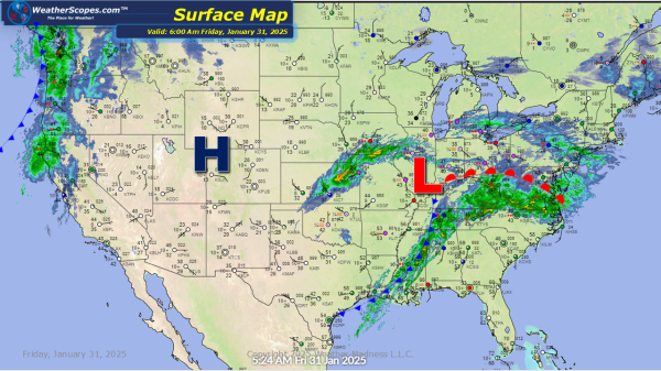
Rain across the Midwest, parts of the Southeast through the Tennessee Valley, and the Northeast. The rain in the Northeast will turn to snow later today and into tonight. Accumulations look to be around a coating to 3''. These areas have had a lot of rain the last 24 hours, some localized flooding is possible.... Continue Reading →

Daily Maps Thursday January 30th, 2025

Some light snow across the Upper Great Lakes today that will move into the Northeast later today. Accumulations look to be around a coating to a 1''. Snow in the Denver metro area with accumulations of around a 1'' with some seeing 1-2'' south of Denver. Storms currently in the South, from Texas into the... Continue Reading →

Daily Maps Wednesday January 29th, 2025

Clipper coming down from the Great Lakes into the Northeast today. Accumulations look to be around a coating to 3'', and upstate NY could see over 4''. Some showers in the DFW area. Rain will stay in the area tomorrow and create some severe weather across Eastern Texas on Thursday. Snow in New Mexico today... Continue Reading →

Daily Maps Tuesday January 28th, 2025

Some snow showers falling in the Northeast with a clipper making its way through the Great Lakes today. That clipper will come through the Northeast as well today into tonight. Accumulations look to be a coating to 3'' in the Northeast, and 1-4'' in the Upper Great Lakes, especially the UP of Michigan which could... Continue Reading →

Website Powered by WordPress.com.

Up ↑