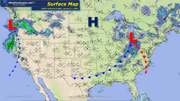
Today some snow in the high Plains which will produce a coating of snow - 1''. That system will continue to the SE today and meet the system that will produce some significant snow and ice this weekend. Snow in the Ohio Valley that will make its way to the coast. Accumulations look to be... Continue Reading →
Daily Maps Thursday January 2nd, 2025
A clipper coming through Iowa into the Midwest and Ohio Valley today into tonight. Snow accumulations look to be around 1-3''. The Northeast is still dealing with some lake effect snow. Erie has seen over 6''+ and will continue to see more today, as well as the Northeast. Accumulations look to be around 1-3''. The... Continue Reading →
Daily Maps Wednesday January 1st, 2025
Hello 2025! Today some lake effect snow in the Great Lakes with a dusting in most areas, around 1-3'' in the UP of Michigan and the Grand Rapids/Lansing area. 3''+ in the Erie area as well from the lake effect snow. Some rain/snow in the Northeast from upstate NY to Maine. That mix will turn... Continue Reading →
Daily Maps Tuesday December 31st, 2024
Rain in the Midwest today that will turn into snow on the back end. Snow accumulations look to be around a dusting. That system will move to the East on Wednesday and produce snow. Some thunderstorms will move through the Virginia's into the DC area, stretching down to the Carolinas today. Those storms look to... Continue Reading →
