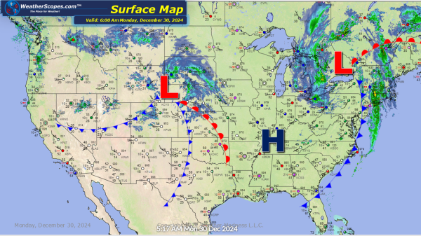
A clipper coming through the plains today with snow accumulations of 1-4” with some areas seeing over 5”+. Some rain and snow making its way out of the Great Lakes and Northeast today. The cold slowly making its return over the Northern Plains.
Weekly Highlights December 29th to January 4th
This week we will start with some severe weather and the chance for tornadoes. Sunday, storms develop in the Southeast and make their way towards the Mid-Atlantic States into Florida. Those storms will produce some gusty thunderstorms and possibly a tornado. Areas along the coast could see some localized flooding from all the rain. Parts of the... Continue Reading →
Daily Maps Sunday December 29th, 2024
Another day for severe weather in the Southeast. These storms are capable of producing tornadoes and damaging wind. The potential for flooding will also be an issue for the Coastal States, and parts of Florida. Rain in the Pacific NW and Great Lakes today. The back end of the storm in the Great Lakes, will... Continue Reading →
Daily Maps Saturday December 28th, 2024
Today we'll be watching the Lower Mississippi Valley and Louisiana for a tornado outbreak. Storms will develop in Eastern Texas and make their way into the Lower Mississippi Valley. Those storms will be severe and a few tornadoes are possible with the favorable conditions. Some Ice fell this morning in parts of the Northeast. Tonight... Continue Reading →
