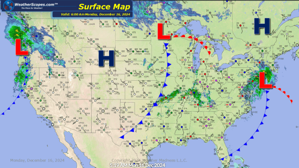
A clipper coming down from the Dakotas into the Great Lakes. Snow accumulations around a coating to 4'' with higher amounts in central Minnesota 6''+ and Wisconsin 4'' + Also some gusty winds associated with the clipper.
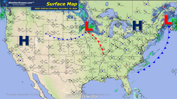
Daily Maps Wednesday December 18th, 2024
Rain and thunderstorms in the Tennessee and Ohio Valley with some hail and winds possible. Those storms will move off to the Northeast and produce some snow. Accumulations will be around 1-4'' for the interior parts of the Northeast with rain south off the snow. Late tonight into tomorrow a clipper will come down through... Continue Reading →
Daily Maps Tuesday December 17th, 2024
Some light snow in South Dakota moving to the East into the Ohio Valley tonight. Accumulations look to be a dusting to 2'' closer to the South Dakota/ Minnesota border. Rains in the Pac NW today with around 2'' of rain near the coast. Some storms look to develop later today around Southern Illinois and... Continue Reading →
Daily Maps Monday December 16th, 2024
Some snow today in the Upper Plains with some light accumulation. Some showers moving through the Ohio and Tennessee Valley today, with the chance for some gusty storms. Those storms will make their way into the Northeast tonight.
