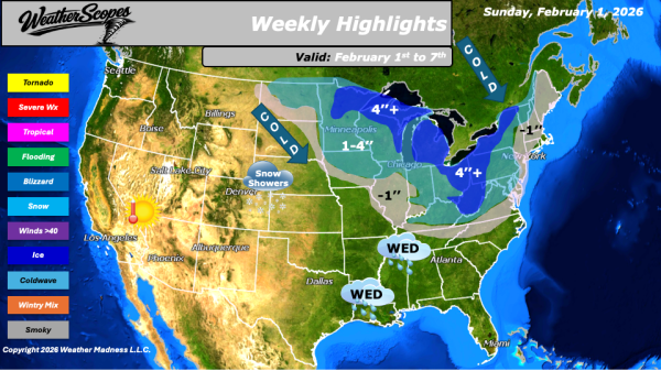
This morning, we are seeing our next clipper come through the Great Lakes. Accumulations look to be light with a coating to the area. Later tonight and into tomorrow another clipper will come through the Great Lakes, the Northeast and into parts of the Mid-Atlantic States. Accumulations tomorrow look to be a coating to 4'',... Continue Reading →
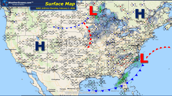
Daily Maps Wednesday February 4th, 2026
This morning, scattered showers are developing ahead of a cold front across the Southeast, bringing cooler conditions to the region by Thursday. Light snow showers are expected in the Great Lakes and Northeast, with minor accumulations possible, generally a light coating. Later tonight, rain will transition to snow extending from eastern Tennessee/Kentucky, into North Carolina,... Continue Reading →
Daily Maps Tuesday February 3rd, 2026
This morning, we are seeing a clipper come through the Ohio and Tennessee Valley. We will see another clipper later today come through parts of the Northeast. Accumulations look to be a coating to 4'' , with the heavier totals across the Ohio Valley into the Appalachians. The Southeast will see some showers come through... Continue Reading →
Weekly Highlights February 1st to 7th
This week’s weather pattern will be active across much of the northern and eastern United States, driven by a series of fast-moving clipper systems. The first clipper will move through the Plains on Sunday before tracking across the Great Lakes and into the Northeast by Monday, bringing periods of light snow and reinforcing colder air.... Continue Reading →
