Daily Maps Friday December 12th, 2025

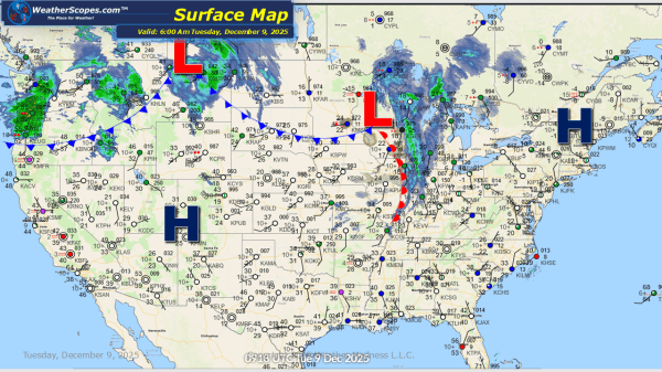
This morning we are seeing some snow across the Virginia's and along the North Carolina border. Accumulations will be light with a coating to 1''. Later today more clippers will come through the Plains, Midwest, Great Lakes and the Northeast tomorrow. Accumulations will be around 1-4'', with some areas only seeing a coating. The Plains... Continue Reading →

Daily Maps Thursday December 11th, 2025

Today we will see a clipper come through the Northern Plains into the Midwest and parts of the Ohio Valley. Accumulations look to be a coating to 4''. Parts of the interior areas of the Northeast will see some lake-effect snows today with accumulations of a dusting to 4'' with the higher totals the closer... Continue Reading →

Daily Maps Wednesday December 10th, 2025

The Pacific Northwest continues to contend with periods of showers and isolated thunderstorms today, maintaining the risk for localized flooding in areas that have already seen several rounds of precipitation. Farther east, it’s another day and another fast-moving clipper sweeping through the Upper Great Lakes and progressing into the Northeast. North of the system, light... Continue Reading →

Daily Maps Tuesday December 9th, 2025

This morning we are seeing another clipper come through the Upper Great Lakes as it moves into the Northeast later today. Tonight yet another clipper will come through the Great Lakes and Northeast into tomorrow. Clipper snow will be the theme for the next 10 days or so with almost daily chances for snow to... Continue Reading →

Website Powered by WordPress.com.

Up ↑