Daily Maps Wednesday November 26th, 2025

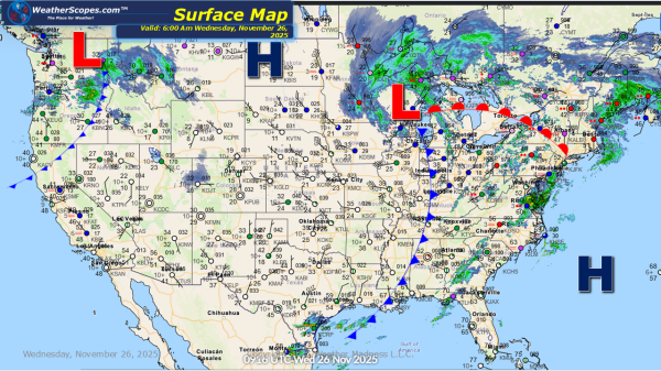
This morning we are seeing the storm which brought wind and snow to the Northern Plains and Upper Great Lakes yesterday, continue to produce snow in the northern portions of MN, WI, and Michigan. Accumulations look to be around 1-4'' with areas in northern Wisconsin and Michigan seeing over 6''. Along with the snow some... Continue Reading →

Daily Maps Tuesday November 25th, 2025

This morning we are seeing a wet start for the eastern part of the US. We have showers and thunderstorms moving through the Southeast into the Ohio Valley. We do have a chance for some more severe weather to develop in the Southeast today with some gusty storms, and the potential for some localized flooding... Continue Reading →

Daily Maps Monday November 24th, 2025

Today we will see some showers and thunderstorms develop in Eastern Texas into the Mississippi Valley. These storms do have the potential to be severe and bring some gusty conditions to the area. A tornado is possible with these storms, if conditions are right. Localized flooding is also a concern with the ongoing rains the... Continue Reading →

Weekly Highlights November 23rd to 29th

This week as we celebrate Thanksgiving, the weather across the United States will be anything but quiet. A dynamic pattern is setting up, bringing everything from severe storms to accumulating snow and an early surge of winter cold for many regions. Travelers heading out for the holiday should plan ahead, as conditions will shift quickly... Continue Reading →

Website Powered by WordPress.com.

Up ↑