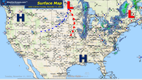
Daily Maps Friday October 24th, 2025

This morning we are already seeing showers and thunderstorms out across the Southern Plains into the Mississippi Valley. More storms will develop today into tonight in Texas and Oklahoma. Some of those storms will be severe bringing heavy rains, winds, hail and a tornado can't be ruled out. Showers in the Pac NW today. Some... Continue Reading →

Daily Maps Wednesday October 22nd, 2025

Today some showers in the Upper Great Lakes and into areas of the Northeast. With these showers waterspouts will develop over the Great Lakes, as well as some gusty conditions. Some showers and thunderstorms will also develop out in the Southwest. The Upper Great Lakes and Northeast feeling the chill in the air with more... Continue Reading →

Daily Maps Tuesday October 21st, 2025

Today a cold front will move into the Great Lakes, Midwest, and parts of the Northeast bringing some cooler weather. Out ahead of the cold front the Upper Great Lakes, Northeast, and down into the Mid-Atlantic states will see some showers. Invest 98L in the Caribbean is looking well organized this morning. I would not... Continue Reading →

Daily Maps Monday October 20th, 2025

Today some showers across parts of the Northeast and Pacific NW. The Northern Rockies could see some snow today in the higher elevations. A cooler air mass will come into the Midwest into the Northeast tomorrow bringing some colder weather, and more fall-like weather. AL 98 is in the Caribbean looking to form over the... Continue Reading →

Website Powered by WordPress.com.

Up ↑