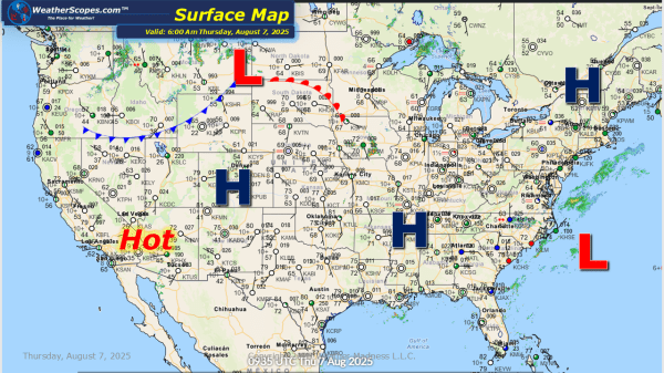
This morning we are already seeing some showers and thunderstorms move across the Midwest. More storms will develop later today and into tonight in the High Plains, which will bring some severe weather to the area. The Four Corner states could see some afternoon thunderstorms develop today. The Southeast still dealing with daily showers and... Continue Reading →
Daily Maps Wednesday August 6th, 2025
Today severe storms will move into the High Plains into the Upper Great Lakes, bringing the chance for heavy rains, hail, gusty conditions, and a tornado is possible. The Southeast continues to see rainy conditions and the possibility of localized flooding. The smoke from the Canadian wildfires still impacting most of the eastern US, and... Continue Reading →
Daily Maps Tuesday August 5th, 2025
Today more severe weather will break out in the High Plains, brining gusty conditions, hail, and the threat of a tornado or two. The Southeast continues to see heavy rains and possible localized flooding. The Ohio Valley could see some isolated thunderstorms develop later in the day. The air quality for the Midwest, Great Lakes,... Continue Reading →
Daily Maps Monday August 4th, 2025
Later today and into tonight storms will break out across the Plains and produce some severe weather. Hail, gusty conditions, heavy rains, and a tornado is possible. This week portions of the Southeast will see some wet and rainy conditions. Some areas in the SE could see several inches of rain, and localized flooding will... Continue Reading →
