Daily Maps Saturday June 21st, 2025

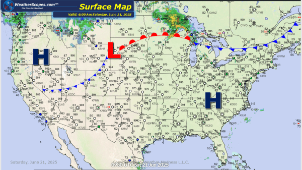
This morning we're seeing some showers and thunderstorms in the Upper Great Lakes. Those storms will continue to move to the east and impact portions of the Northeast later tonight and into tomorrow. Later today more storms will develop in the Northern Plains, which some storms could be severe. The concern for the next few... Continue Reading →

Daily Maps Friday June 20th, 2025

Today we will see some showers and thunderstorms in the Northern Plains into the Upper Great Lakes and parts of the Northeast today into tonight. With the heat coming to parts of the Midwest to the Mid-Atlantic states all the severe weather will be pushed up to the north. Some localized flooding also possible with... Continue Reading →

Daily Maps Thursday June 19th, 2025

This morning some showers and thunderstorms in the Upper Great Lakes, and in the Southeast. Later today some severe storms will develop out ahead of a cold front in parts of the Northeast and Mid-Atlantic States. These storms will bring heavy rains, windy, hail, and a possible tornado. Localized flooding will also be a concern... Continue Reading →

Daily Maps Wednesday June 18th, 2025

Today more severe storms will develop out across the Midwest into the Tennessee and Mississippi Valleys's. These storms will bring heavy rains, hail, gusty conditions, and tornadoes. With the heavy rains in the Midwest, expect to see some flooding potential. These storms will be ongoing for most of the day and into the evening. The... Continue Reading →

Website Powered by WordPress.com.

Up ↑