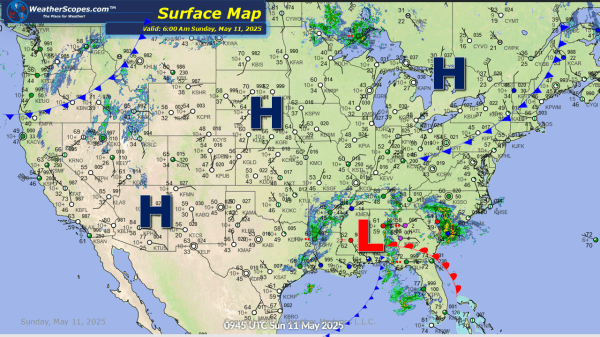
This week as we have gone away from the omega blocking pattern of last week and will see several days of severe weather, and wet and stormy weather in the east. On Sunday into Monday showers and thunderstorms will continue in the Southeast and parts of Florida. That area will have seen 2-6’’ of rain... Continue Reading →
Daily Maps Sunday May 11th, 2025
Today showers and thunderstorms continue in the Southeast into Florida as this system continues to dump rain into the area. 2-6'' of rain is expected for the area, and flooding will be a big issue today and tomorrow. Some of these storms could be severe today. Across parts of Montana and into the Dakotas later... Continue Reading →
Daily Maps Saturday May 10th, 2025
This morning we are seeing showers and thunderstorms across the Southeast into Florida and in parts of the Northeast, these storms don't look to be severe. With the rains in the Southeast over the last day and for the next few days, flooding will be the biggest threat. 2-6'' of rain is expected to fall... Continue Reading →
Daily Maps Thursday May 8th, 2025
Today showers and thunderstorms across the Tennessee Valley into parts of the Northeast, as well as southern Texas. Across the Tennessee Valley damaging winds and hail will be the biggest threat. Localized flooding will also be something to watch as these areas have seen a decent amount of rain over the last few days. Some... Continue Reading →
