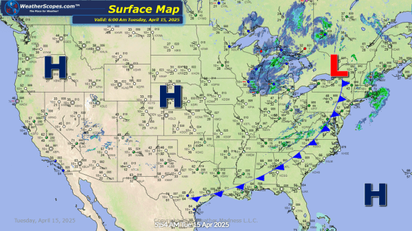
Today rain and some snow showers will make their way through the Great Lakes into the Northeast. Snow in the UP of Michigan and will move into parts of NY and PA later tonight and into tomorrow. Accumulations will be light at around 1''. Rest of the US looking good and warm. The Great Lakes... Continue Reading →
Daily Maps Monday April 14th, 2025
Severe weather will break out in parts of Kentucky into the Baltimore area. With these storm hail and wind damage will be the impacts. The dew points will not be high enough to produce any tornadoes. Snow in the Upper Great Lakes today. Accumulations look to be around 1-4''. Behind the snow some cooler air... Continue Reading →
Weekly Highlights April 13th to 19th
This week we continue to be in a pattern of warm in the West and cool/wet in the East. Monday, some severe weather returns in the Ohio and Tennessee Valley’s, as storms will produce some hail and gusty conditions. The dew points won't be high enough to produce any tornadoes. Also on Monday, portions of the Upper Great... Continue Reading →
Daily Maps Sunday April 13th, 2025
Parts of the Northeast still dealing with the coastal storm this morning. Rain along the coast from Massachusetts to Maine. Further north around Caribou, Maine the rain has turned to snow. Northern Maine could see 2-4'' of snow from this system today. The rest of the US looks pretty good today. Hot weather across the... Continue Reading →
