Daily Maps Thursday February 20th, 2025

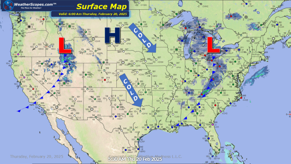
We are still feeling the cold in the Plains, Great Lakes, and Northeast. This weekend looks to be a bit warmer for most of us with temps above freezing! Some snow showers in the Great Lakes through the Northeast and into the Mid-Atlantic states today. Accumulations look to be around a coating to 3-4'' in... Continue Reading →

Daily Maps Wednesday February 19th, 2025

Still dealing with cold temps throughout the Plains into the Great Lakes and Northeast. Some snow making its way across the Ohio and Tennessee Valley today and into tonight. Accumulations look to be a coating to 4'' for most of the Ohio and Tennessee Valley with some higher amounts near the Kentucky / West Virginia... Continue Reading →

Daily Maps Tuesday February 18th, 2025

Dangerous cold right now through the Plains into the Great Lakes and Northeast, with temps and wind chills below zero. Our snowstorm making its way through the Plains, Oklahoma, and into the southern parts of Illinois and Indiana. The KC / Topeka area, along with the northern part of Arkansas, should see the highest snowfall... Continue Reading →

Daily Maps Monday February 17th, 2025

Some lake effect snow through the Great Lakes and parts of the Northeast. A coating to 4'' of accumulating snow for the Great Lakes and areas of upstate NY to Maine. The Syracuse area could see 6''+ today into tomorrow. Snow making its way across the Plains with accumulations of 1-4''. Arctic cold coming down... Continue Reading →

Website Powered by WordPress.com.

Up ↑