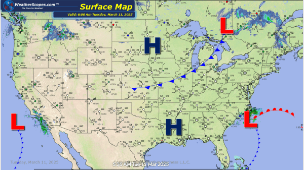
Some light snow showers across the Northern Great Lakes and Northeast. Accumulations look to be around a coating to 1'' possibly 2'' close to the Syracuse area. Rain in the Pacific NW, and in Louisiana that will make its way across the Gulf Coast states into Florida later tonight and into tomorrow. Some milder temps... Continue Reading →
Daily Maps Saturday February 22nd, 2025
A clipper coming through the Northern Great Lakes into parts of the interior Northeast later tonight. Accumulations look to be light with just a dusting. Some heavy rains in the Pacific NW this weekend. The cold weather that many of us dealt with this week looks to be taking a break. The next few days... Continue Reading →
Daily Maps Friday February 21st, 2025
The Plains and Great Lakes still dealing with some cold temps to start the day. Some snow going through parts of the Great Lakes and into the Northeast with accumulations of a coating to a 1''. The Denver area seeing some snow, and have been since last night. Accumulations look to be around 3-6'' with... Continue Reading →
Daily Maps Thursday February 20th, 2025
We are still feeling the cold in the Plains, Great Lakes, and Northeast. This weekend looks to be a bit warmer for most of us with temps above freezing! Some snow showers in the Great Lakes through the Northeast and into the Mid-Atlantic states today. Accumulations look to be around a coating to 3-4'' in... Continue Reading →
