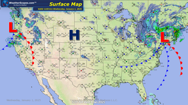
Hello 2025! Today some lake effect snow in the Great Lakes with a dusting in most areas, around 1-3'' in the UP of Michigan and the Grand Rapids/Lansing area. 3''+ in the Erie area as well from the lake effect snow. Some rain/snow in the Northeast from upstate NY to Maine. That mix will turn... Continue Reading →
Daily Maps Tuesday December 31st, 2024
Rain in the Midwest today that will turn into snow on the back end. Snow accumulations look to be around a dusting. That system will move to the East on Wednesday and produce snow. Some thunderstorms will move through the Virginia's into the DC area, stretching down to the Carolinas today. Those storms look to... Continue Reading →
Daily Maps Monday December 30th, 2024
A clipper coming through the plains today with snow accumulations of 1-4” with some areas seeing over 5”+. Some rain and snow making its way out of the Great Lakes and Northeast today. The cold slowly making its return over the Northern Plains.
Weekly Highlights December 29th to January 4th
This week we will start with some severe weather and the chance for tornadoes. Sunday, storms develop in the Southeast and make their way towards the Mid-Atlantic States into Florida. Those storms will produce some gusty thunderstorms and possibly a tornado. Areas along the coast could see some localized flooding from all the rain. Parts of the... Continue Reading →
