Daily Maps Friday December 20th, 2024

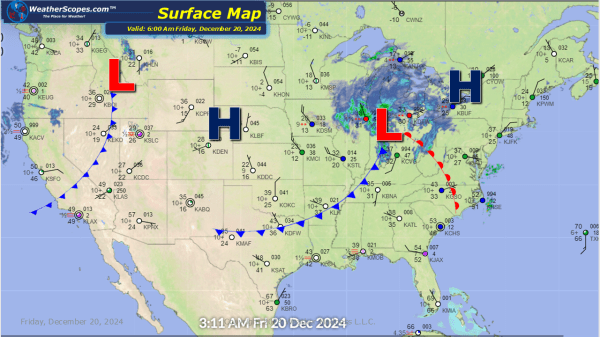
A few clippers coming in today. Another one coming into the Great Lakes this morning with accumulations around 1''. That clipper will move to the Northeast and produce 1-4'' of snow with higher amounts possible in the Rochester area. Behind this clipper there will be some lake effect snow 1-4'' Later today a small clipper... Continue Reading →

Daily Maps Wednesday December 18th, 2024

Rain and thunderstorms in the Tennessee and Ohio Valley with some hail and winds possible. Those storms will move off to the Northeast and produce some snow. Accumulations will be around 1-4'' for the interior parts of the Northeast with rain south off the snow. Late tonight into tomorrow a clipper will come down through... Continue Reading →

Daily Maps Tuesday December 17th, 2024

Some light snow in South Dakota moving to the East into the Ohio Valley tonight. Accumulations look to be a dusting to 2'' closer to the South Dakota/ Minnesota border. Rains in the Pac NW today with around 2'' of rain near the coast. Some storms look to develop later today around Southern Illinois and... Continue Reading →

Website Powered by WordPress.com.

Up ↑