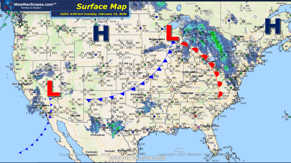
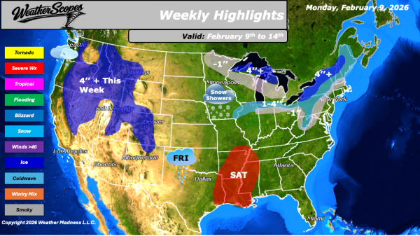
This morning, we are seeing a clipper come through bringing snow to upstate NY, through Vermont, New Hampshire and into Maine. Another clipper will come through the area again on Wednesday. Total accumulations look to be over 4'' for the area. While areas to the south will see 1-4'' from these clippers over the next... Continue Reading →
Weekly Highlights February 9th to 14th
This week’s weather pattern will bring a mix of milder temperatures, winter systems, and the potential for severe weather across different parts of the country. Some milder weather is expected across the Plains into the Midwest this week, with temperatures climbing above the freezing mark. While it will not feel warm by any stretch, this... Continue Reading →
Daily Maps Sunday February 8th, 2026
This morning, we are seeing some light snow come through the Great Lakes and into the Ohio Valley. Accumulations look to be around a coating to 2''. In the Pacific NW showers will come through the area and also bring some snow to the Northern Rockies. The Northeast still dealing with the cold this morning... Continue Reading →
Daily Maps Saturday February 7th, 2026
This morning, we are seeing snow across the New England area and portions of the Northeast, from a clipper coming down. Accumulations look to be a coating in most areas with 1-4'' of snow in the New England area. Gusty conditions along with some arctic cold will impact the Northeast today, bringing some dangerous wind... Continue Reading →
