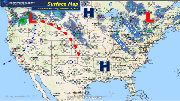
Daily Maps Friday November 7th, 2025

Today the Pacific NW will see more showers and thunderstorms, with the higher elevations of the Rockies seeing some snow. Showers and thunderstorms will break out across the Midwest, Upper Great Lakes, and Northeast. There is a chance for some of these storms to be severe in areas in the Tennessee Valley. Behind these storms... Continue Reading →

Daily Maps Thursday November 6th, 2025

Today more showers and thunderstorms in the Pacific NW. Some scattered showers across parts of the Northeast as well as some cooler temps. There is a chance tomorrow for some severe weather to develop across the Tennessee Valley. Still watching some clipper snow to come into parts of the Plains, Midwest, and Northeast over the... Continue Reading →

Daily Maps Wednesday November 5th, 2025

Today the Pac NW and Northern California will see some showers and thunderstorms come into the area. More showers and thunderstorms are making their way across the Upper Great Lakes and into the Northeast later tonight, bringing some cooler temps and windy conditions. Some higher elevations in the Northeast could see a mix of some... Continue Reading →

Daily Maps Tuesday November 4th, 2025

Today the Pac NW will continue to see some showers throughout the day, and the Northern Rockies could see some snow in the higher elevations. The Northeast will see some cooler temps today after a cold front came on through yesterday bringing some showers and thunderstorms. Some of those storms in the New England area... Continue Reading →

Website Powered by WordPress.com.

Up ↑