Daily Maps Wednesday September 3rd, 2025

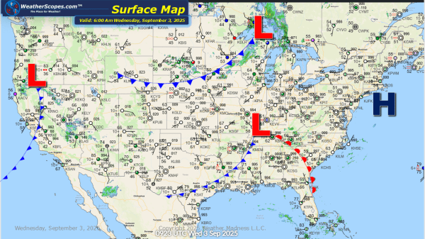
This morning we are already seeing some showers and thunderstorms make their way across the Great Lakes and Plains. That will continue today as more storms develop later today that could become severe out in the Plains. The Southwest will see some locally heavy rain, which could lead to some localized flooding. The NE portion... Continue Reading →

Daily Maps Tuesday September 2nd, 2025

Today we will see some showers and thunderstorms in the Upper Great Lakes, and across the Tennessee Valley, and areas of the Southeast. Parts of the Southwest will see some locally heavy rains, which could lead to some localized flooding. We are also watching a tropical wave off the coast of Africa, which the NHC... Continue Reading →

Weekly Highlights August 31st to September 6th

This week we will see some heavy rains, cool temps, and some gusty conditions. From Sunday into Monday, heavy rains will impact the Plains into portions of Texas, bringing the risk of localized and flash flooding. Tuesday and Wednesday, scattered showers and thunderstorms will move through the Upper Great Lakes and the Midwest. Thursday looks to be a busy day of weather this week. A blast... Continue Reading →

Daily Maps Sunday August 31st, 2025

Today some heavy showers and thunderstorms in the Plains and most of Texas. These storms will bring some gusty conditions and heavy downpours which could lead to some localized and flash flooding. Wildfire smoke now impacting parts of the Midwest and Southeast, from all the fires burning out in the west. No activity in the... Continue Reading →

Website Powered by WordPress.com.

Up ↑