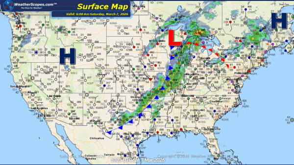
Daily Maps Wednesday February 18th, 2026

This morning, a dynamic weather pattern is unfolding across the United States as a strong storm system tracks from the Northern Plains into the Upper Great Lakes. This system is producing a wide range of precipitation types, with snow falling on the colder northern side, mixed precipitation in transition zones, and steady rain across areas... Continue Reading →

Daily Maps Monday February 16th, 2026

This morning, we are seeing showers coming through California and the Pacific NW. The rain will impact these areas throughout the week, with California seeing the potential for some localized flooding. With the wet and stormy conditions out in the west, The Rockies and Sierras will see several inches of snow this week. Much of... Continue Reading →

Weekly Highlights February 15th to 21st

This week’s weather pattern across the United States will feature a dynamic mix of severe storms, heavy rain, accumulating snow, and a return to colder air by next weekend. Multiple systems moving from west to east will bring changing conditions to many regions, with some areas experiencing more active weather than others. To start, some... Continue Reading →

Daily Maps Friday February 13th, 2026

This morning, not a whole lot going on. The Northeast still dealing with some cold temperatures with areas in the teens and single digits. A clipper will come through portions of the Northeast later tonight and into tomorrow bringing a coating of snow. In the Southwest some showers will come through the area, bringing snow... Continue Reading →

Website Powered by WordPress.com.

Up ↑