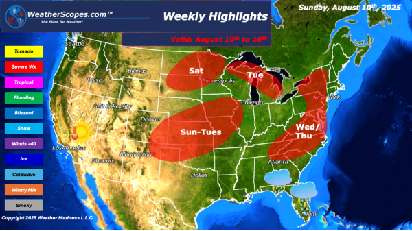
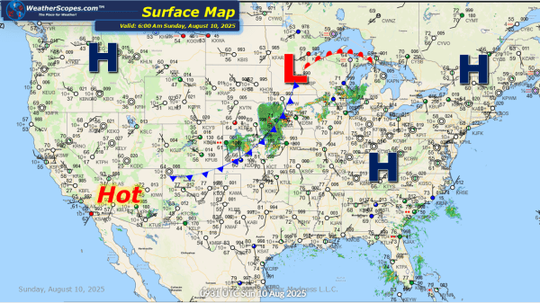
This week we will see some severe storms break out in the Plains and into the Midwest on Sunday through Tuesday. Warmer temps and higher dew points in this area could spawn some tornadoes. Off the Florida coast there is an upper-level low bringing some rain to Florida. That system should last a few days and could bring several inches of... Continue Reading →
Daily Maps Sunday August 10th, 2025
This morning we are seeing some showers and thunderstorms making their way through the Midwest. Some of those storms could produce some heavy rains, and some localized flooding is possible. The Southeast will also see some showers and thunderstorms today. Later tonight some storms will develop across Oklahoma into Texas. Some of those storms could... Continue Reading →
Daily Maps Friday August 8th, 2025
Today the severe weather will be across the Dakota's in to MN and WI. These storms will bring heavy rains, gusty conditions, hail, and a possible tornado. Localized flooding will also be an issue with all the rain. The west continues to be hot and dry, which is not helping the wildfires. The Midwest, Great... Continue Reading →
Daily Maps Thursday August 7th, 2025
This morning we are already seeing some showers and thunderstorms move across the Midwest. More storms will develop later today and into tonight in the High Plains, which will bring some severe weather to the area. The Four Corner states could see some afternoon thunderstorms develop today. The Southeast still dealing with daily showers and... Continue Reading →
