Daily Maps Wednesday May 21st, 2025

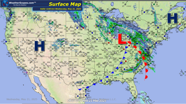
This morning the Midwest and Northeast are dealing with some showers. That trend will continue today as the Mid-Atlantic states, parts of the Ohio Valley and the Northeast will see some gusty storms form. These storms don't look to be severe. The Mississippi Valley will see some severe storms develop later tonight. Flooding will be... Continue Reading →

Daily Maps Tuesday May 20th, 2025

Showers and thunderstorms already this morning across the Northern Plains into the Midwest. That will continue throughout the day as those showers and thunderstorms will turn severe in the Ohio and Tennessee Valley's into the Mississippi Valley. With these storms wind, hail, heavy downpours, and tornadoes are all in play. Today could be another day... Continue Reading →

Daily Maps Monday May 19th, 2025

We are looking at another day of severe weather today. Showers and thunderstorms will form across the Plains and into parts of Texas and the Mississippi Valley. With these storms heavy rains, hail, damaging winds and tornadoes are all possible. Some localized flooding will be another issue today especially in the Mississippi Valley with some... Continue Reading →

Weekly Highlights May 18th to 24th

This week we continue to see severe, wet, and cooler weather in the East, while the Southwest and southern areas of Texas will see very warm temps. Sunday, showers and thunderstorms will develop in the Southeast, and parts of the Northeast. These don’t look to be severe and will just produce some rain. Monday, storms will develop... Continue Reading →

Website Powered by WordPress.com.

Up ↑