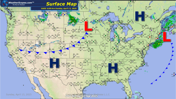
Today snow and ice will impact parts of the Northeast from NY to Maine. Accumulations look to be around 1'' for snow and .10'' of ice. That system extends all the way back to the Upper Great Lakes for parts of WI, MN, and the UP of Michigan that will see snow and ice. Accumulations... Continue Reading →
Daily Maps Saturday March 29th, 2025
Today we have snow and some mixed precipitation coming through parts of the Northeast. Parts of Upstate NY, Vermont, New Hampshire, and Maine could see over 4'' of snow and some ice. We have some thunderstorms moving through the Plains into the Midwest and Ohio Valley today, as well as the Mississippi Valley, today and... Continue Reading →
Daily Maps Friday March 28th, 2025
Some rain and thunderstorms moving through the Midwest and Southern Texas today. Southern Texas once again dealing with heavy rains and localized flooding. Rain in the Pacific NW, and snow in parts of Maine today with accumulations of a dusting. Later tonight some more snow and rain moves into the Northeast. Parts of upstate NY,... Continue Reading →
Daily Maps Thursday March 27th, 2025
Another milder day for most of the US. Some storms still in Southern Texas, some of those could be severe today. Southern Texas could see over 4'' of rain from all the rain they are getting. Some rain going through the Pacific NW. Some storms making their way through the Midwest today.
