This week while we start off with some warmer for December temps, that will change by mid-week. On Wednesday, a cold front will move into the Plains, Midwest, Northeast, and parts of the Southeast. Out ahead of the Cold front the Southeast will see some rain and gusty storms. On Sunday, parts of the Northeast and Maine will see some snow accumulations around 1-3’’. The Upper Plains/Great Lakes will see rain turn into snow throughout the day with some accumulations of around 1-4’’. The Great... Continue Reading →
Weekly Highlights November 24th to 30th
This week we will be in a similar weather pattern as we were last week. Cold air coming down from the North with multiple chances for snow. This holiday week looks to be a snowy and cold one for most of us. To start the week the Upper Great Lakes will see some snow on Monday and Tuesday with accumulations of 1-4’’. They will also see snow... Continue Reading →
Daily Maps Thursday November 21st, 2024
Snow will impact the Great Lakes, the Ohio Valley and move into the Northeast today bringing several inches of snow accumulation. The Pac NW still continues to deal with heavy rain and flooding.
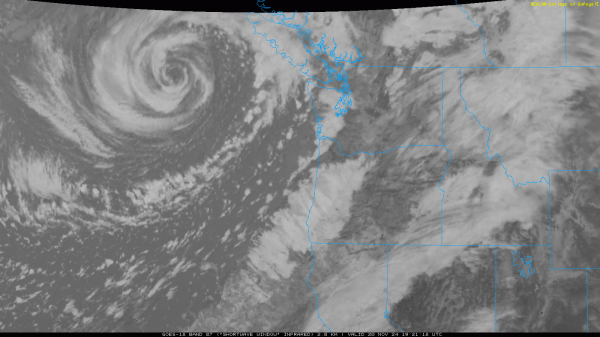
Bomb Cyclone In the Pacific NW?
Im sure when you woke up today and heard about the bomb cyclone that was impacting the Pacific NW, you would have thought it was a made up phenomenon. Or if you're reading this post and thinking what am I talking about let me explain. The Pacific NW has been dealing with heavy rain and... Continue Reading →


