This week as we have gone away from the omega blocking pattern of last week and will see several days of severe weather, and wet and stormy weather in the east. On Sunday into Monday showers and thunderstorms will continue in the Southeast and parts of Florida. That area will have seen 2-6’’ of rain... Continue Reading →
Weekly Highlights December 29th to January 4th
This week we will start with some severe weather and the chance for tornadoes. Sunday, storms develop in the Southeast and make their way towards the Mid-Atlantic States into Florida. Those storms will produce some gusty thunderstorms and possibly a tornado. Areas along the coast could see some localized flooding from all the rain. Parts of the... Continue Reading →
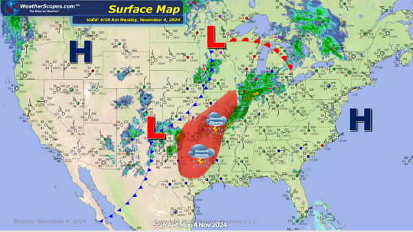
Daily Maps Monday November 4th, 2024
Storms continue in the Plains and Midwest, also a new disturbance in the Caribbean we’ll have to watch over the next few days.
Weekly Highlights November 3rd to 9th
This week we still find ourselves in a weather pattern where there is a trough in the West, and a ridge in the East. Cold weather in the West , warmer weather in the East, especially the Southeast. The ENSO is staying neutral in regard to El Nino and La Nina, but the middle of the month look for... Continue Reading →


