
A Look at the Winter Forecast for 2024-2025
Issued September 1, 2024
The question this winter will be the state of the ENSO or El Nino Southern Oscillation which is simply whether we are in the an El Nino or La Nina pattern. My concern this winter is that the pattern going into fall looks highly La Nina but ends up being mostly neutral conditions from late November through March. Neutral ENSO conditions trend colder and a bit snowier across the Midwest into the Northeast and Appalachians. This is going to be very tricky as the climate models are trending colder for this winter than in past winters where warmth had overwhelmed most of the country.
Below is the comparison between the La Nina and Neutral Weather patterns. The difference between the two is that the split pattern does not occur in the Pacific thus driving the trough into the eastern part of the country with all the cold weather.


Another comparison is to look at the ECMWF SST anomalies which are if you look closely shows a weak La Nina to neutral conditions. The argument while the SST look colder, it’s only colder by -0.5 degree C which is boarding on neutral conditions or a very weak La Nina. As of September 1, the SOI values have been showing a fairly consistent La Nino values.


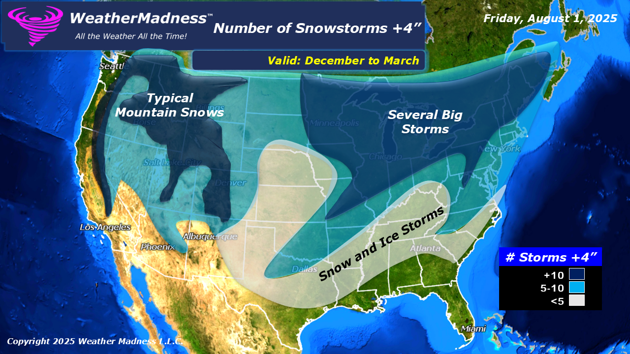
The forecast maps below are based on neutral to weak La Nina pattern. The bulk of the snowstorms will through the Midwest into the Great Lakes and Northeast including the Appalachians. The Mid-Atlantic is the tough forecast as has been the issue the past couple of winters. The snow will depend on the extent of the cold and the secondary storm development. I expect the AO to be negative most of the winter which will drive the trough axis into the Mississippi Valley but with the AO negative, that will tend to drive a more negative NAO or blocking pattern which can lead to significant storms along the East coast. The West will have a dry winter as the storm track does not favor spilt flows in the Pacific. That means the bulk of the storms will go through the PAC NW and not as much into California. I can see Santa Ana Wind problems this winter in Southern California. The Front Range of the Rockies is another tricky forecast as shots of Arctic air will come down the Front Range but that only means light snows and very few major snowstorms.
Click on Image to See Bigger Image


Issued August 1, 2024

Issued July 2024

