
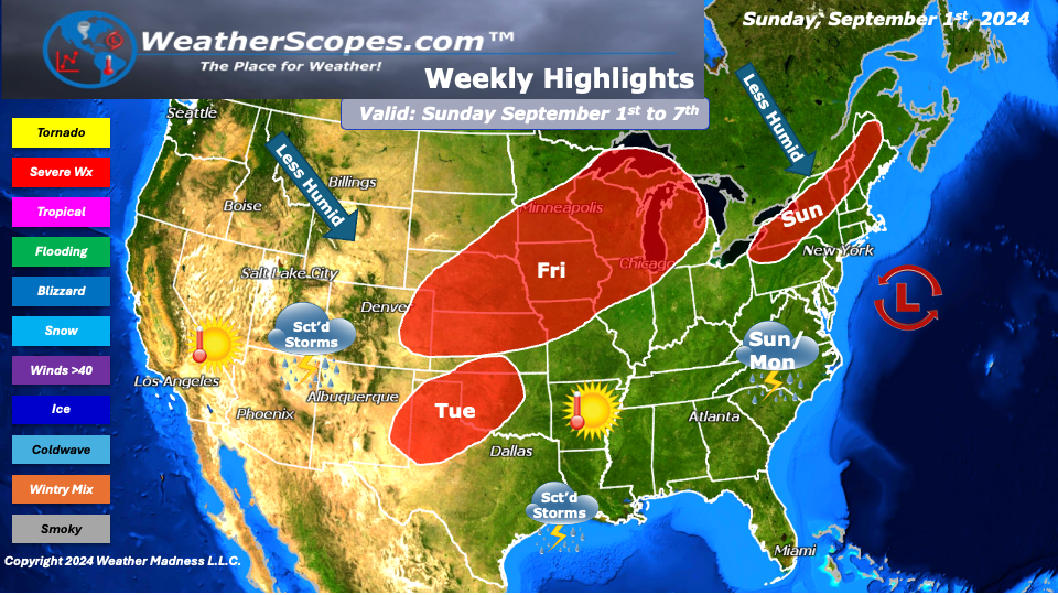
This holiday week we will see the heat stay south, with comfortable and less humid temps across most of the US. There will be some scattered showers and thunderstorms throughout the week, some may be severe. Our focus will be at the end of the week. The models are showing an upper-level low form and track towards the Eastern seaboard. We will have to keep an eye on it during the week to see if anything does form and cause some heavy rain and flooding to the Northeast.
On Friday, the Plains and Midwest will see a threat for some severe weather and strong storms. The moist warm air from the south will make its way North and meet up with some precipitation across the Plains that will turn into a bigger storm. That upper-level low will make its way East across the Midwest and Ohio Valley. With the chance of severe weather don’t rule out heavy rain, wind, and a possible tornado. There will also be some more scattered storms along Texas and the Gulf Coast to start the week, which has seen a lot of rain the past few days.
The West continues to be warm and dry. The monsoonal rains look to be scattered this week across the Four Corner States. The fire danger this week continues to increase in the Pacific NW, California, Texas, and areas of the Four Corner States.
The tropics still don’t look like anything will form this week. The upper-level low that could affect the Eastern seaboard at the end of the week looks to start off the coast of Florida and gain some strength and makes its way North.
By Matt K.
Weather Forecaster In-Training

Leave a comment