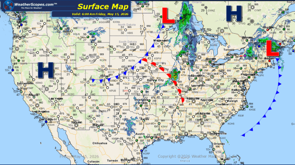
This morning, we are seeing showers moving across portions of the Midwest, New Hampshire into Vermont, and parts of the Pacific Northwest. Later today and into the overnight hours severe weather is expected to develop from the Midwest through the Plains and into Texas. These storms could produce heavy rainfall, hail, and strong wind gusts... Continue Reading →
Daily Maps Thursday May 14th, 2026
This morning, we are seeing showers moving across portions of the Northeast. Later today, severe thunderstorms will develop across Kansas and the southern Plains as a more active weather pattern takes shape. Additional showers and thunderstorms are expected to develop across the Dakotas and track eastward into Minnesota and the Great Lakes through tonight. Windy... Continue Reading →
Daily Maps Wednesday May 13th, 2026
this morning, we are seeing showers moving across the Northeast and extending southward into the Appalachians. These areas, along with portions of the Tennessee Valley and Mid-Atlantic, could see gusty thunderstorms develop today. Some of these storms will produce heavy rainfall, leading to the potential for localized flooding in areas that experience repeated downpours. Out... Continue Reading →
Daily Maps Tuesday May 12th, 2026
This morning, we are seeing showers and thunderstorms moving across the Great Lakes, parts of the Southeast, and northern Florida. These areas, along with portions of the Ohio Valley into the Northeast, could see additional gusty storms develop later tonight and into the overnight hours. Localized flooding will also be a concern across portions of... Continue Reading →
