

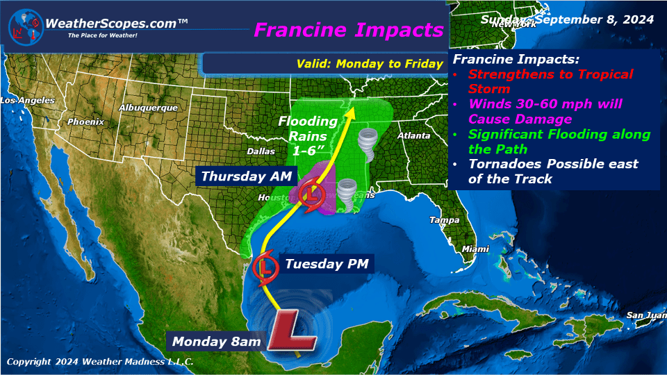
This week the Southeast and Texas continue to get dumped on by a low-pressure system that will produce heavy rain and flooding to an area who has already seen a lot of rain and flooding. Francine is making her way up from the Gulf and is expected to be named in the next day or two. It remains to be seen if Francine will strengthen to a hurricane or just stay a tropical storm. Mid-week we will see Francine impact the Texas and Louisiana Coast for a few days before moving to the North and East. Those areas have already been dealing with heavy rains and flooding for about a week now, so flooding this time from Francine could be catastrophic. As Francine tracks to the North and East we can expect some heavy rains, localized flooding, and some chances of tornadoes. The Mississippi and Tennessee Valley will deal with Francine towards the end of the week.
The rest of the US will have some nice weather. The plains, Midwest, and parts of the Northeast will see temps rise into the 80’s and 90’s for a few days. The Southeast will be wet this week with multiple days of rain. The west will continue to be sunny, warm, and dry. There will be some chances of scattered storms throughout the week in the Four Corner States and northern Rockies. The West and Pacific NW continues to be on high alert for fire danger with multiple wildfires still burning.
There will be a chance of severe weather Friday night into Saturday morning across the High Plains that could produce some gusty storms.
By Matt K.
Weather Forecaster In-Training

Leave a comment