
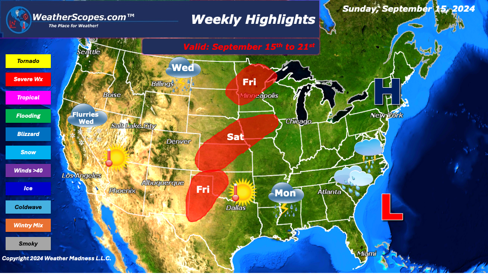
This week we will see another round of the weather not really knowing what it wants to do. To start the week, we will be watching a Low-pressure system off the coast of the Carolinas to see if it will develop into anything. That low could produce some heavy rains to an area where it has been dry and much needed. It could gain some tropical characteristics and be named by the National Hurricane Center, but we will have to wait and see. That Low-pressure system will bring some winds along the Eastern Seaboard from the High-pressure system in the Northeast. With the High-pressure system and the Low-pressure system jockeying for position it will cause some onshore flow up and down the coast, from south of New Jersey to the Carolinas. That on shore flow will make it windy along the coast and beaches, as well as some possible beach erosion to occur.
The West remains warm, dry, and still dealing with several wildfires. Some of the smoke from these wildfires has made its way to all the way over to the Northeast, even causing the radar to pick up the smoke. The Sierra’s Nevada’s could see some snow flurries mid-week. The Plains and parts of the Upper Great Lakes could see a round or two of storms to end the week. Some of those storms could have the potential to be severe.
The heat comes back this week in Texas as well as The Plains. Temps look to be in the 80’s and 90’s. The Northeast will have some nice cooler weather this week and may see some showers from the remnants of the Low-pressure system off the coast of the Carolinas, making its way to the Northeast.
By Matt K.
Weather Forecaster In-Training

Leave a comment