
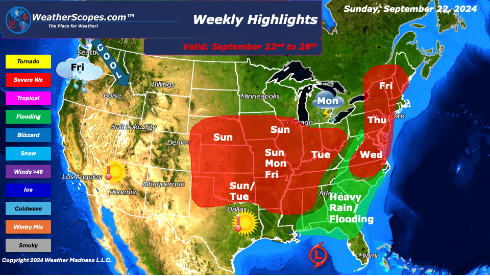
This week our focus is what is going to happen in the tropics? Based on the indices we should see a storm come up from the Caribbean and impact the East Coast next weekend. We will have to see what develops if it’s a hurricane or a low-pressure system, It is still too early to tell. The models are all over the place and frankly don’t know what to do. Helene will be the next named storm. The next few days we will need to watch where the impacts will be and where landfall could occur. This system expect rain, potential flooding, severe weather, and high winds and tides along the East Coast.
Multiple rounds of severe weather returns this week in the Plains, Midwest, parts of the Ohio and Tennessee Valley, and the Northeast. We should see daily storms in these areas, and some of those storms could be severe with a tornado or two not out of the question. Some areas could see some localized flooding as well.
The West continues to be sunny and warm. The wildfires still are raging in some parts with no real relief from mother nature to help tame the fires. Texas, the Plains, and the Southeast will be where the warmth is this week. There will be a storm coming out of the Pacific later in the week that will bring some rain, cooler temps, and snow showers to the Pacific NW. There may be some snow acculumation especially in the mountains.
By Matt K.
Weather Forecaster In-Training

Leave a comment