
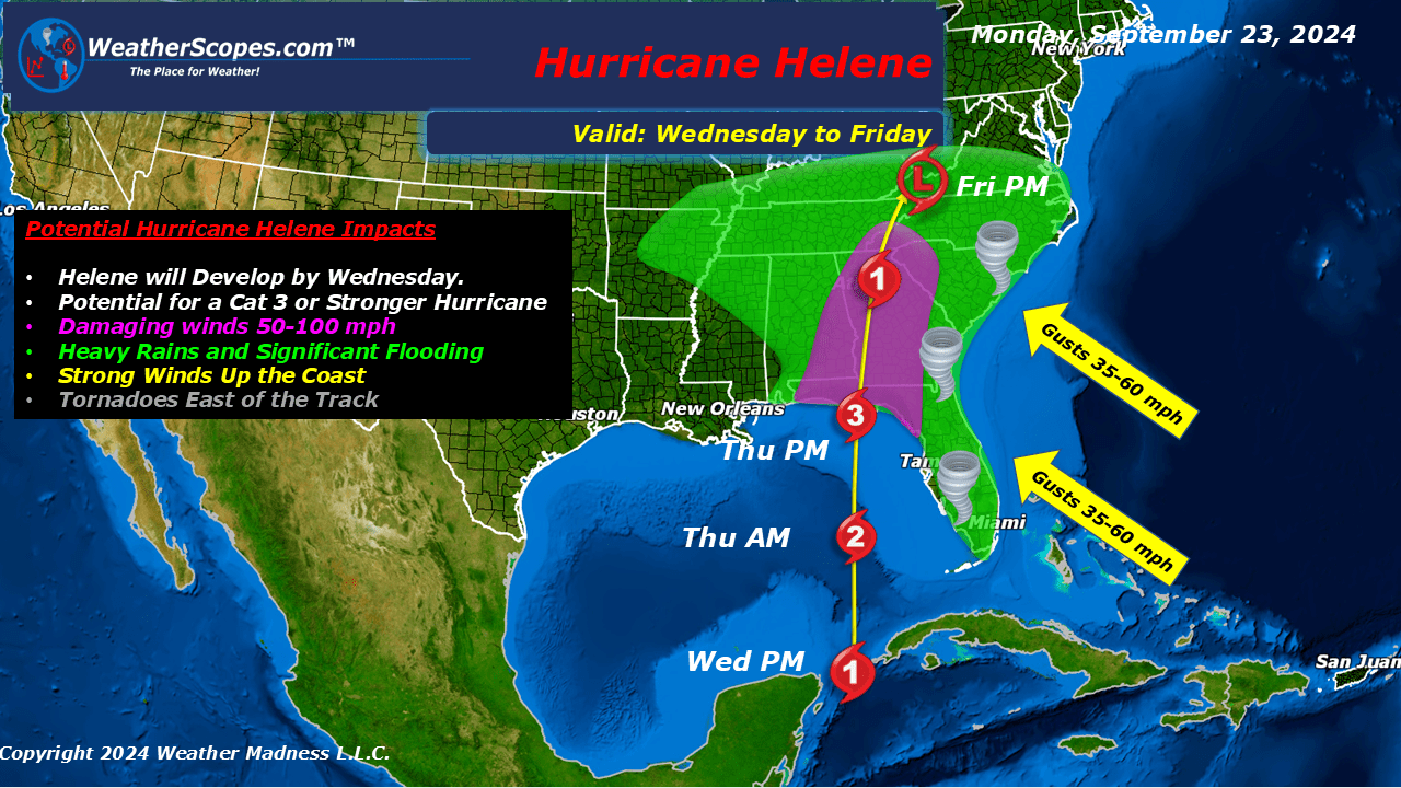
Helene the next named storm, is continuing to develop in the Caribbean. In the next 36-48 hours you will see Helene intensify and become a Hurricane. I will continue to update this week about Helene’s track and potential impacts.

Below the potential wind speeds as of Monday, to the Florida Panhandle at landfall.

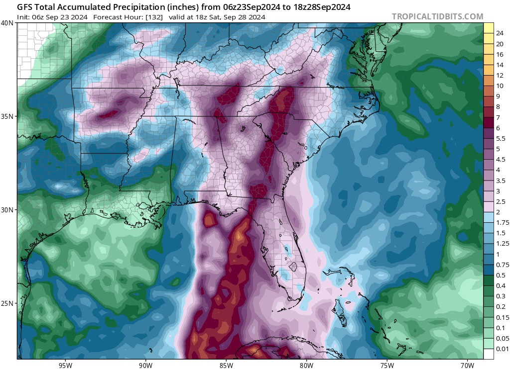
Above is the potential flooding to Florida, Georgia, and the Carolinas.

Above is the view of Helene forming in the Yucatan Basin which is just Southeast of Cancun Mexico, in the Caribbean. This picture is taken from a buoy floating in Caribbean from the NOAA.

Leave a comment