

Today Helene was upgraded to a Tropical Storm and still developing in the Caribbean. TS Helene looks a little disorganized today compared to yesterday, with some dry air and wind shear not helping the development process. TS Helene still has the potential to gain strength when she enters the Gulf’s warm waters. It’s interesting to note the models have in the last 24 hours decreased the strength of Helene at landfall. The next 24-48 will be crucial if Helene will become a powerful hurricane.
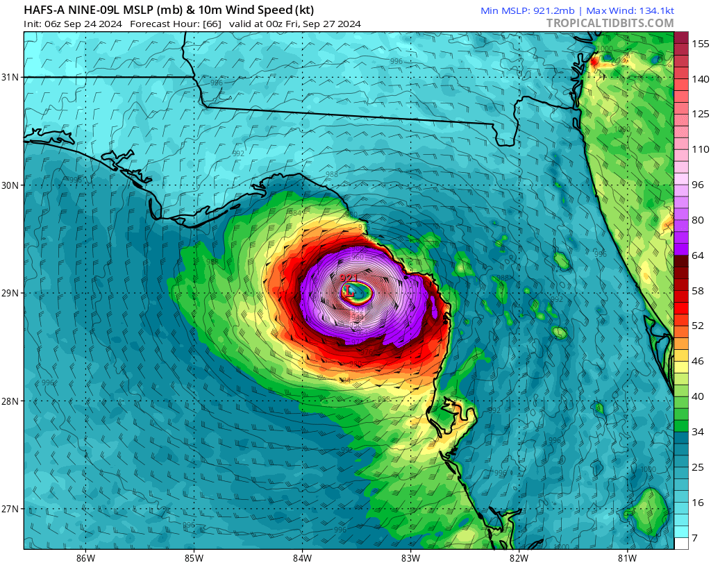
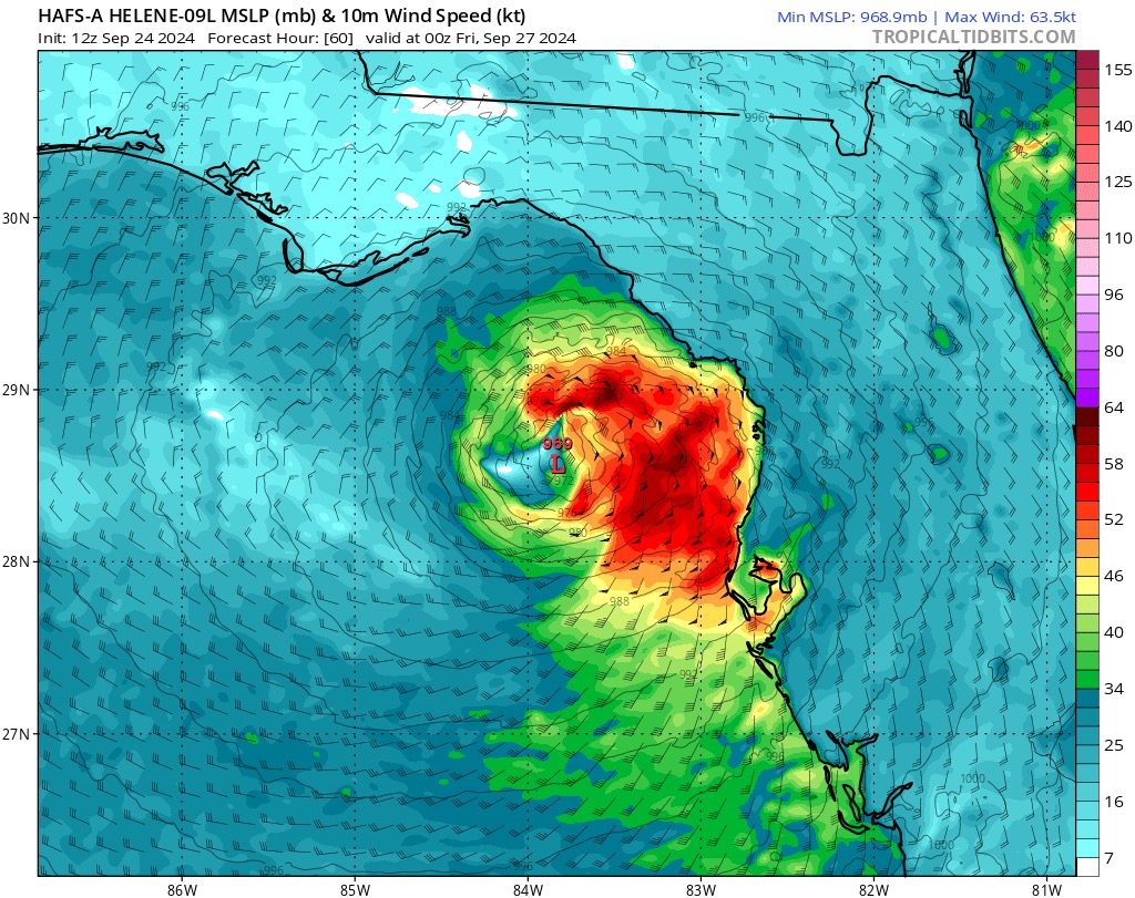
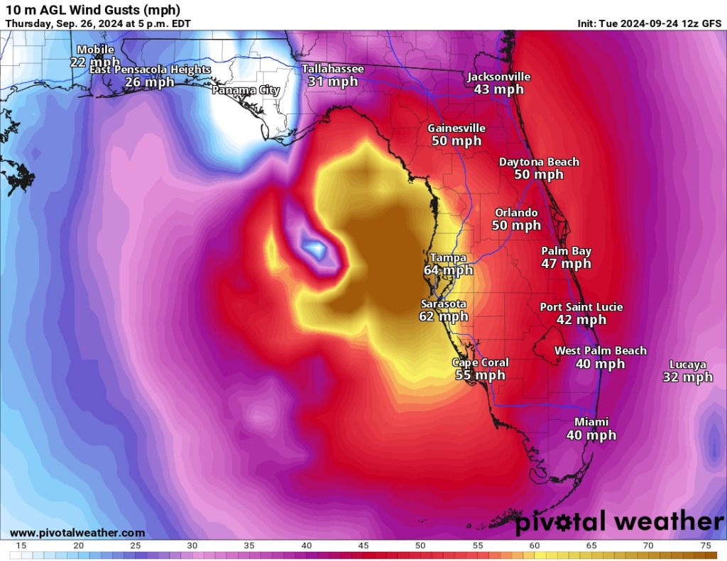
The above models show TS Helene landfall wind speeds in knots and MPH. The second image is only 6 hours later than the first, and predicts Helene will weaken when making landfall. The third image also shows some less powerful winds than expected. There still is time to gain strength in the Gulf and we will have to wait and see over the next 48 hours.

Leave a comment