
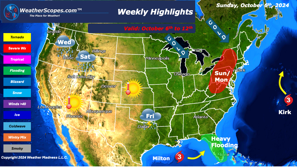
This week we will see another hurricane develop in the Gulf and impact most of Florida. Right now, Tropical Storm Milton is making his way through the warm waters of the Gulf and getting stronger. By mid-week TS Milton should developinto a Category 3 hurricane and make landfall near the Tampa Bay area, an area severely impacted by Hurricane Helene. Most of Florida will see heavy rain, wind, dangerous flooding, and some severe storm surge. With Milton the potential for severe weather and tornadoes will also impact the area. The models have changed rather quickly for Milton, and we will have to keep watching to see if Milton intensifies even more. Before Milton makes landfall, Florida will be dealing with some showers and thunderstorms to start the week, which will enhance how bad the flooding could be.
Cold, dry air from Canada will makes its way down and bring the Northeast and Upper Great Lakes some colder temps. The Northeast could see its first frost of the season mid-week, as well as the Upper Great Lakes. The Northeast will also see a round or two of severe weather to start the week. A tornado with these storms isn’t out of the question. The West continues to be sunny, warm, and dry. The Pacific NW will see a round of showers mid-week, and to end the week. The Plains and Midwest will see some nice comfortable weather this week.
By Matt K.
Weather Forecaster In-Training

Leave a comment