
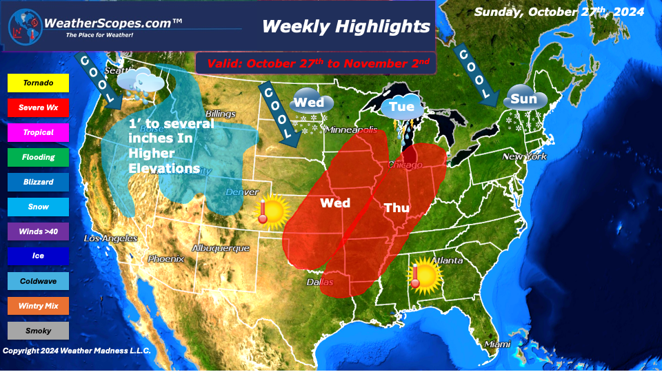
This week we will see some more active weather than we have in recent weeks. On Sunday, the Northeast will see some snow showers with maybe a dusting in some spots and an inch in the Adirondacks. The drought in parts of the Northeast will continue to be and issue especially with the fire danger increasing.
Warm temps return this week for the Plains as well and the South, and Southeast with temps in the 80’s. That will change come Wednesday when a cold front moves through the Plains and cools everything back down and will bring snow showers to the Dakotas, and the Northern tip of Minnesota.
On Tuesday we’ll see some showers come through the Upper Great Lakes. Those storms don’t look to be severe. Wednesday and Thursday, there will be the better chance for severe weather as a system moves into the Midwest and the Mississippi and Ohio Valley from the West. With the storms mid-week those storms could be gusty with the chance of some hail.
The West will see cooler temps this week with the weather pattern were still in. Multiple days this week the West will see snow accumulation of an inch to several inches in the higher elevations, especially in the Rockies and Pacific NW.
We will have to keep an eye on the tropics to see if anything does develop in the next few days to a week. Its still too early to tell if something will form based on some of the model runs, or if this ends the tropic season.
By Matt K.
Weather Forecaster In-Training

Leave a comment