

This week we will see severe storms in Texas to a potential snowstorm in parts of the Northeast. To start the week some severe weather will form in Texas/Oklahoma on Sunday and continue to move to the North into the Plains. With these storm you’re looking at some heavy rain, wind, and the potential for hail with these storms. I would be surprised if a tornado formed out of these storms with the rotation tracks looking weak. On Tuesday and Wednesday the Gulf Coast and Florida will see the chance for some heavy rain, and some severe weather. That system will be from the remnants of Tropical Storm Sara. TS Sara didn’t do much while she formed in the Caribbean, which was a good thing, and never affected the US. I think its safe to say the tropical season is over and now were on to a cold, and snowy weather pattern.
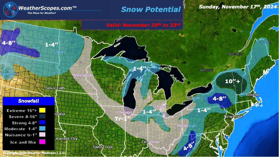
For most of the US cold air will makes its way down from Canada and bring some colder temps than we have been seeing the last few weeks. On Wednesday we’re looking at a system come into the Great Lakes/Ohio Valley, and the Northeast that will bring some rain mixed with snow in some parts. Some areas will see snow accumulation, others will see some mixed precipitation from Weds to Sat. Along with the rain/snow mix, to end the week the Northeast will see temps barely make it out of the 30’s.
The Pacific NW continues to see a lot of rain and snow in the Higher elevations of the Rockies. Throughout the week snow in the Rockies could top out at around 3ft of accumulation. Parts of Montana will also see some significant accumulating snow. The Denver area will also see a few inches of snow this week as well. For the Denver metro area, I don’t think this round of snow will be anything like the snowstorm they saw a few weeks ago. The next two weeks looks to be a busy weather pattern with more and more accumulating snow falling to much of the US.
By Matt K.
Weather Forecaster In-Training

Leave a comment