
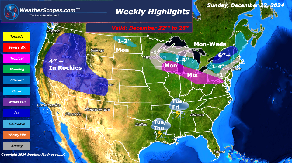
This week as we celebrate the holidays we will see some light lake effect snow bands in the Great Lakes and Northeast on Sunday. Accumulations look to be less than an inch. On Monday, a clipper will come through the Great Lakes into the Northeast late on Monday that will hang out until Wednesday. With the snow some areas of the Great Lakes and Northeast will see some mixed precipitation. Some wet snow and freezing rain might put a damper to those with some last-minute Christmas shopping. Most of the Northeast will see a dusting to around 4’’ of snow with parts of upstate NY, Vermont, and New Hampshire seeing over 6’’+. Central Michigan and Wisconsin could see around 4’’, with areas to the North and South seeing a dusting to 4’’.
Tuesday, Thursday and Friday we will see gusty storms develop in Texas to the Mississippi Valley. With those storms they do have the potential to be severe, and the potential to bring around 1’’ of rain to the area. Over the course of the week, The Rockies will see some significant snowfall totals with accumulations over 4”+. Later in the week, we will see a break in the cold for the Plains, Midwest and parts of the Northeast. Temps in those areas could reach 50, but most will be happy to be above freezing.
Happy Holidays!
By Matt K.
Weather Forecaster In-Training

Leave a comment