
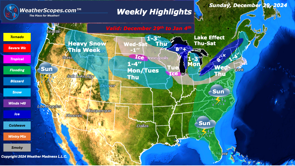
This week we will start with some severe weather and the chance for tornadoes. Sunday, storms develop in the Southeast and make their way towards the Mid-Atlantic States into Florida. Those storms will produce some gusty thunderstorms and possibly a tornado. Areas along the coast could see some localized flooding from all the rain. Parts of the Midwest and Great Lakes will also see rain on Sunday. As the system leaves the area, parts of Michigan will see some wet snow on the backend of the rain Sunday night into Monday. Accumulations look to be around 1-3’’.
As we get into the work week, two clippers will come into the Plains on Monday into Tuesday, and on Thursday. These clippers will bring some accumulating snow, with totals around 1-4’’ and some areas seeing 4’’+. The Midwest will see rain come into the area on Tuesday into Wednesday with a chance of some mixed precipitation, and a dusting of snow in some spots. That system will move to the Northeast on Wednesday into Thursday, that will produce some snow. Accumulations look to be around 1-4’’. The Northeast and parts of the Great Lakes will also have to deal with some lake effect snow to end the week. Those areas could see 8”+ of lake effect snow.
The Pacific NW will continue seeing rain and snow as those systems move to the East and affect the rest of the US. The Rockies this week will see a decent amount of snow, with areas higher up in elevation seeing around 2 feet of snow.
The cold returns this week in the Plains, Great Lakes, and Northeast, setting the stage over the next few weeks for some snowstorms. Hopefully, everyone enjoyed the warmer than usual temps this past week, because it is going to be a cold and snowy January.
By Matt K.
Weather Forecaster In-Training

Leave a comment