
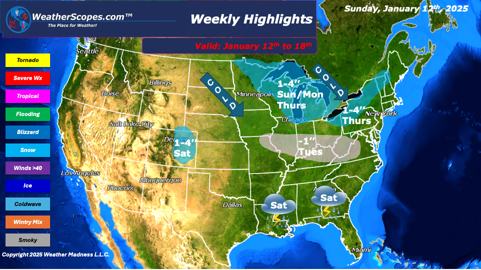
This week we will see a few clippers come through and bring some cold and windy weather with it. A pretty quiet week on the horizon before the next few have the potential to produce some snowstorms. To start on Sunday the Northern Great Lakes will see a clipper produce 1-4’’ of snow throughout the day and into Monday, where it will move out of the area. Cold Arctic air will follow these clippers bringing temperatures in the teens, and some gusty wind to start the week.
On Tuesday, our next clipper will come through Iowa and into the Ohio Valley bringing a coating to 1’’ of snow. Thursday into Friday, the next clipper comes through the Great Lakes and into the Northeast. Accumulations look to be 1-4’’ The Northeast could see some lake effect snow throughout the week with accumulations of 2-4’’. Saturday, snow in the Denver Metro area 1-4’’, and some storms in the Southeast. Next Sunday could be our next snowstorm, but it is still too early to tell since the models change with every run. With the rain to the Southeast and the cold to the North it should be interesting if the models can agree on a storm next weekend.
The LA area still is dealing with devastating wildfires that have impacted a lot of land and property. The Santa Ana winds look to come back this week and next. While not as strong as the area saw, the winds wont help the firefighters as they try and contain these blazes.
By Matt K.
Meteorologist In-Training

Leave a comment