
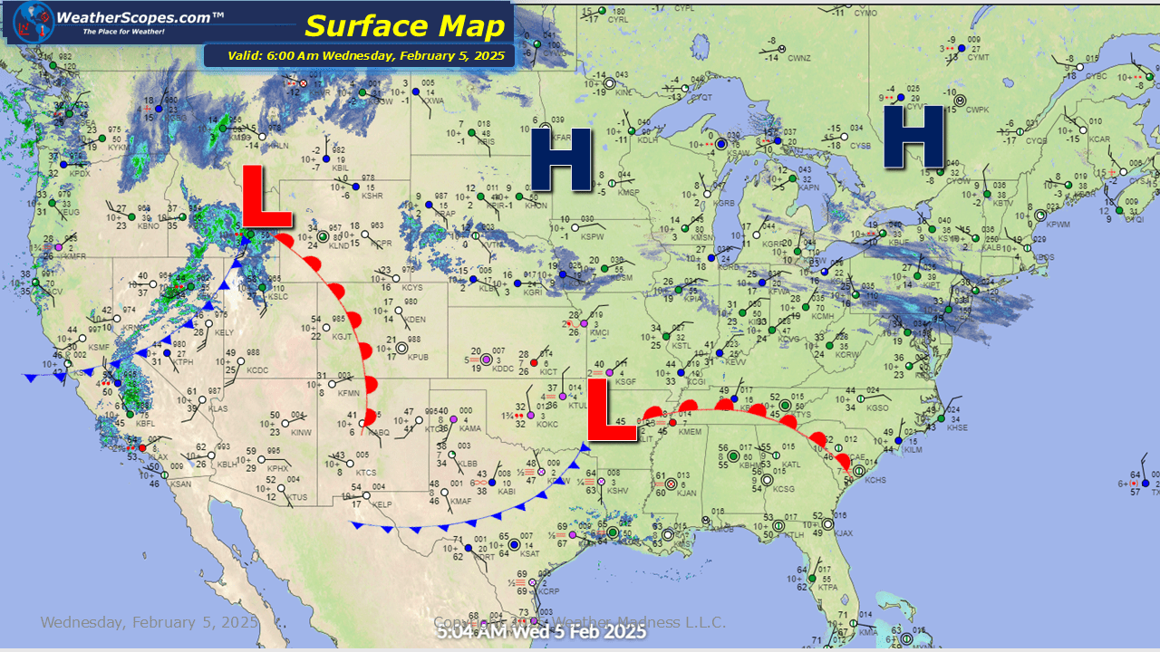
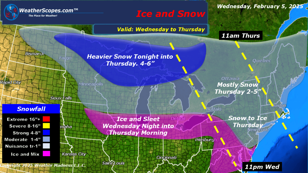
A system coming into the Upper Great Lakes that will produce a moderate amount of snow 4-6” to the northern areas and around 2-5” for the rest of the Great Lakes. Along with that system another one to the south will roll into parts of Iowa and Illinois through the Ohio Valley and into parts of the Northeast tonight and into tomorrow. With this system ice and sleet will be the main threat. As the storm moves to the east, snow will be out ahead of it. Accumulations look to be around 2-5” to the Northeast.

Leave a comment