

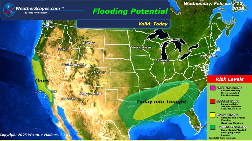
Our second snowstorm of the week is making its way through the Plains and Midwest. It will continue to move to the east and impact the Great Lakes and Northeast. Heaviest accumulations look to be 4-8” for portions of Kansas to the Great Lakes and into the Northeast, and some areas of the interior areas of the Northeast seeing 8”+. The rest will see 1-4” of snow. South of the snow you will see some mixed precipitation with sleet and ice, from portions of Missouri through the Ohio Valley and into the Virginia’s. In the Southeast heavy rains today with some of those storms becoming severe.


Leave a comment