
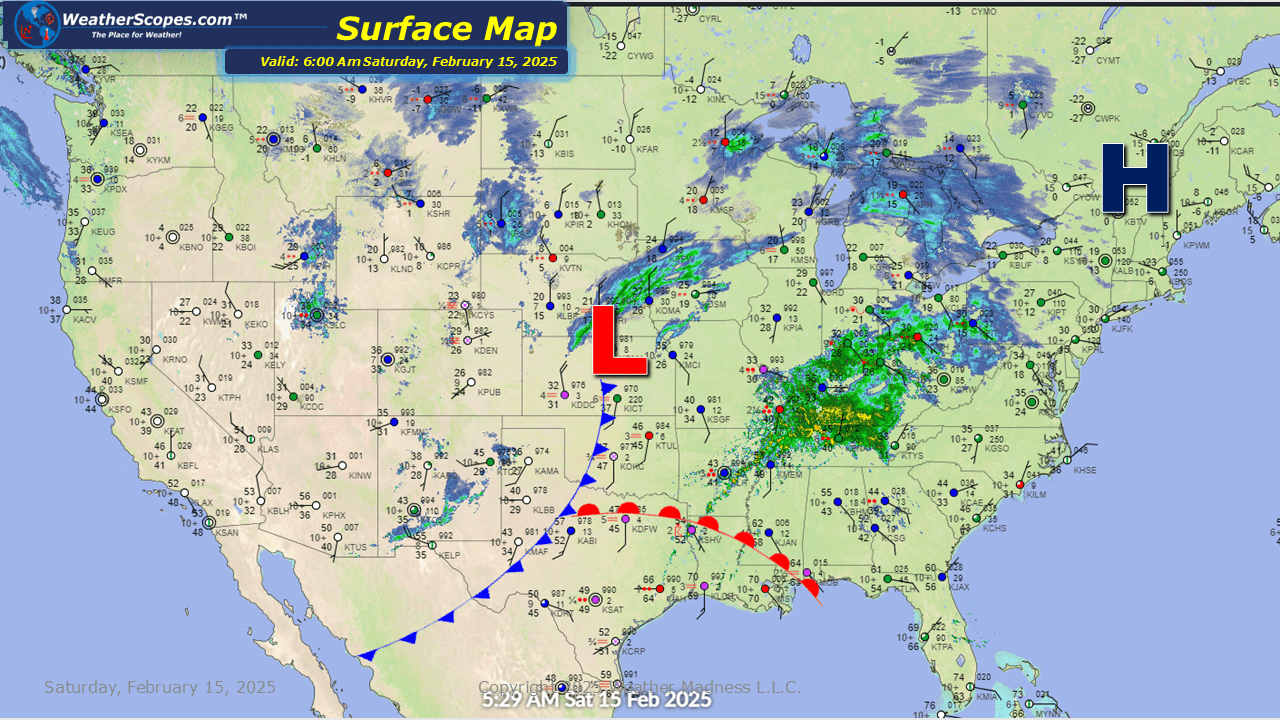
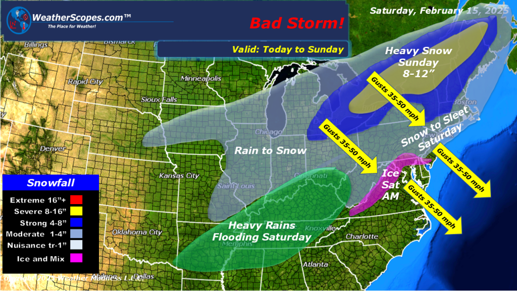
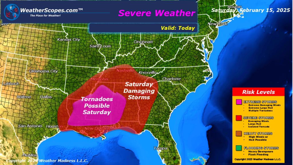
Snow continuing today in the Midwest, Great Lakes and into the Northeast. Accumulations look to be a coating to 4”. Higher amounts in the Northeast, Michigan, and parts of Nebraska. Along with the snow moving through, some mixed precipitation and ice will accompany it in areas of the Ohio Valley. Later today some strong storms will develop in Arkansas and Louisiana and move to the east. With these storms heavy rain, wind, hail, and tornadoes are possible. Flooding will be something to watch for, as areas in the Tennessee Valley could see 3-4” of rain with these storms.


Leave a comment