
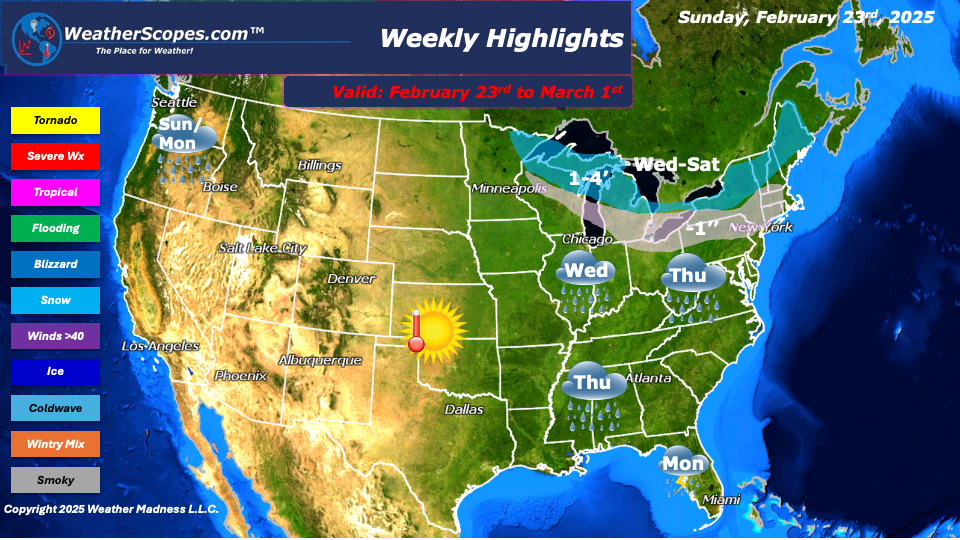
This week looks to be a rather quiet weather week, as mild temperatures return. Most of the week looks to be above freezing until next weekend, where we will see the cold return after its break in the Great Lakes and Northeast. Temps in the Plains this week could reach 60 degrees. It’s definitely a nice change from the below zero temps the Plains have been dealing with over the last several weeks. On Sunday, some snow showers will move into parts of the Great Lakes and Northeast with some light accumulations of a coating to 1’’. Sunday and Monday look to be stormy for the Pacific NW as rain continues in the area. Parts of the NW could see some localized flooding from all the rain they have seen. Also, some snow for parts of Maine on Monday with accumulations of a coating to 1’’.
Wednesday, our next clipper will come through the Northern Great Lakes and move into the Northeast by Wednesday night into Thursday. Accumulations look to be a coating to 1’’. Rain will also move through the Plains and into the Midwest.
Thursday, looks to be wet for the Midwest through the Ohio Valley and into the Mid-Atlantic states, as showers will come through the area. The Northeast will see some accumulating snow from the clipper that went through the Great Lakes on Wednesday. Accumulations look to be around a coating to 2”.
Saturday into next Sunday, another clipper will come through the Northern Great Lakes and into the Northeast, with the potential to produce heavier snowfall amounts. Accumulations look to be around 2-4’’ Those amounts could change by the end of the week.
By Matt K.
Meteorologist In-Training

Leave a comment