
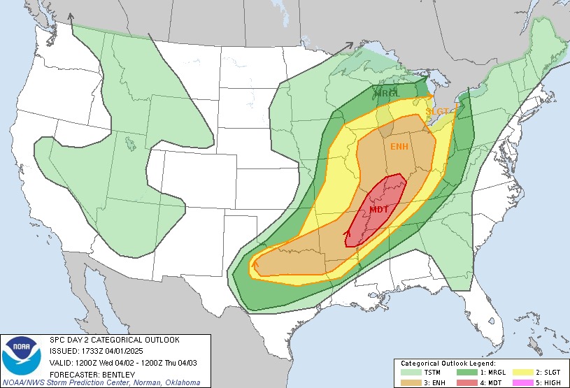
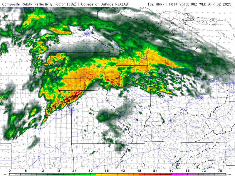
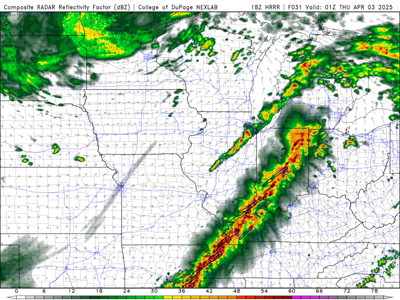
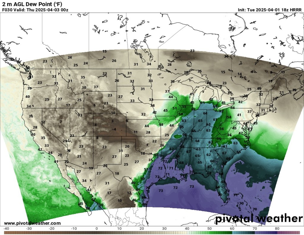
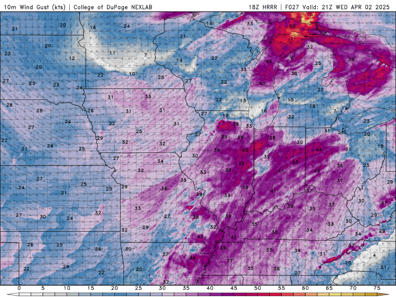
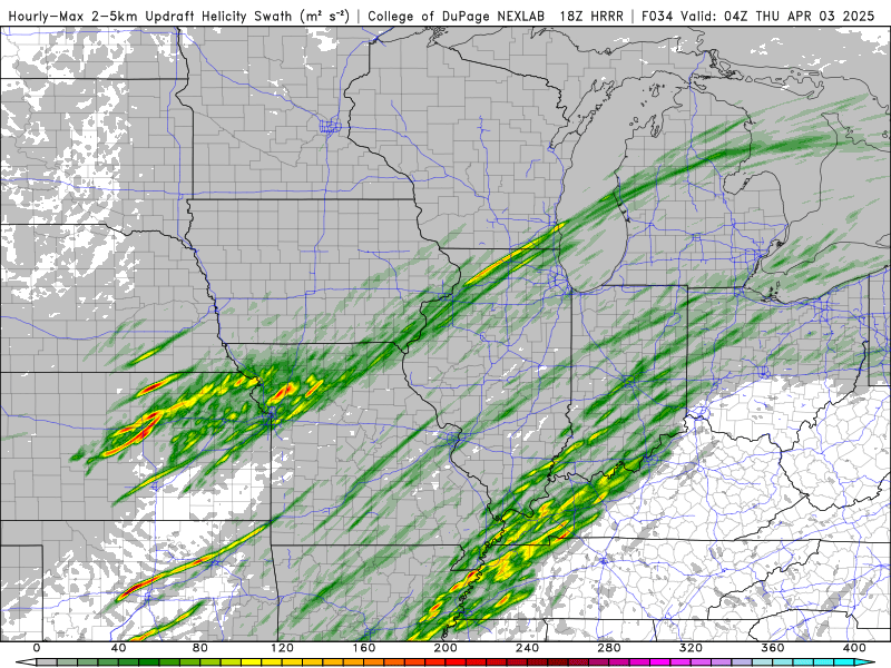
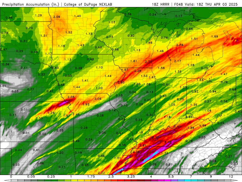
Tomorrow looks to be quite the severe weather event. The SPC has highlighted a large area of the Mississippi Valley into the Ohio Valley as a place where severe weather will be prevalent. As you look at the HRRR resolution radar images you can see how massive these storms will be. The updraft helicity (measures the amount of rotation in a storms updraft) is strong in the Southern Plains and Western Kentucky into the Mississippi Valley. Tornadoes aren’t a guarantee in those areas just like anything is weather but the likelihood is high. I think that is where you will see most of the tornadoes break out, and I’m sure there will be more tornadoes developing from these storms. The wind gusts associated with these storms will also be powerful a something to keep an eye on. With these storms coming through there will also be flooding to the areas affected that could potentially be a life threatening event. Some areas could see 4-6” of rain in a 24 hour span. This system will take its time moving to the east, which will produce even more rain to the area. Wednesday will be quite the day to watch the weather in the Mississippi and Ohio Valley, The Plains, and Midwest.

Leave a comment