

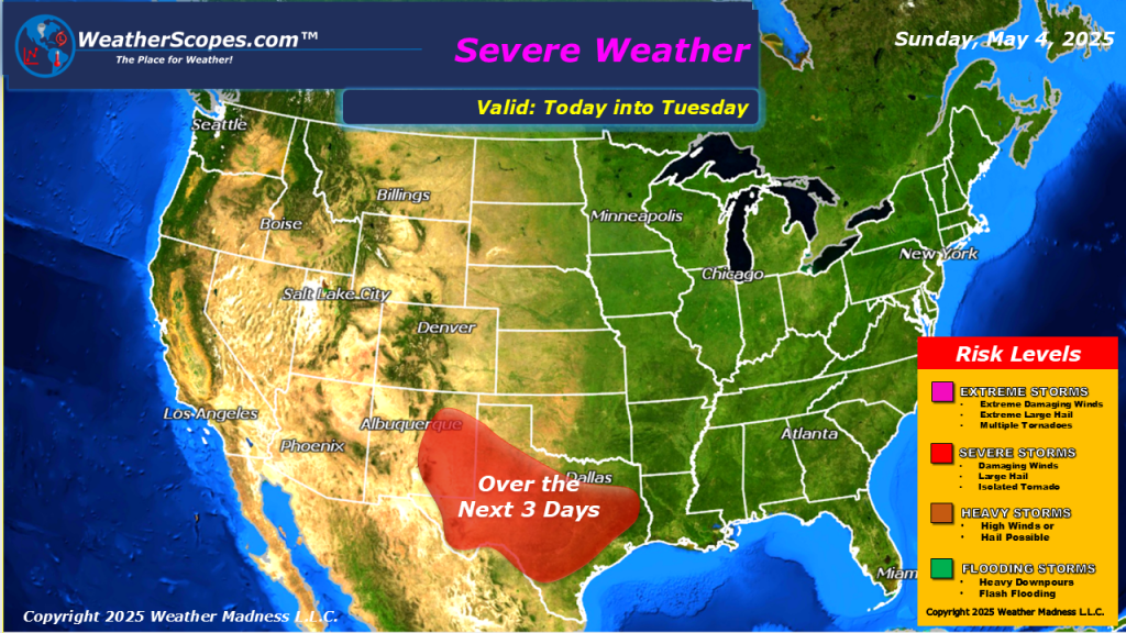
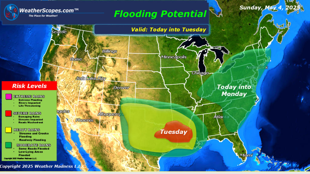
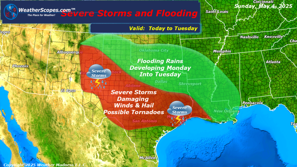
Today we are still dealing with an omega blocking pattern where two low-pressure systems are closed off from the jet-stream, which brings cool unsettled weather to the West and East. With this pattern the East will see daily chances for showers and thunderstorms until mid-week. Texas will see some chances of severe weather over the next few days, bringing heavy rains, hail, gusty conditions, and tornadoes. Localized flooding also will be an issue for parts of the East into the Mississippi Valley from the rain that has been ongoing and that will continue until mid-week. Warm weather today will be in the Plains and the Southern areas of the SW.

Leave a comment