
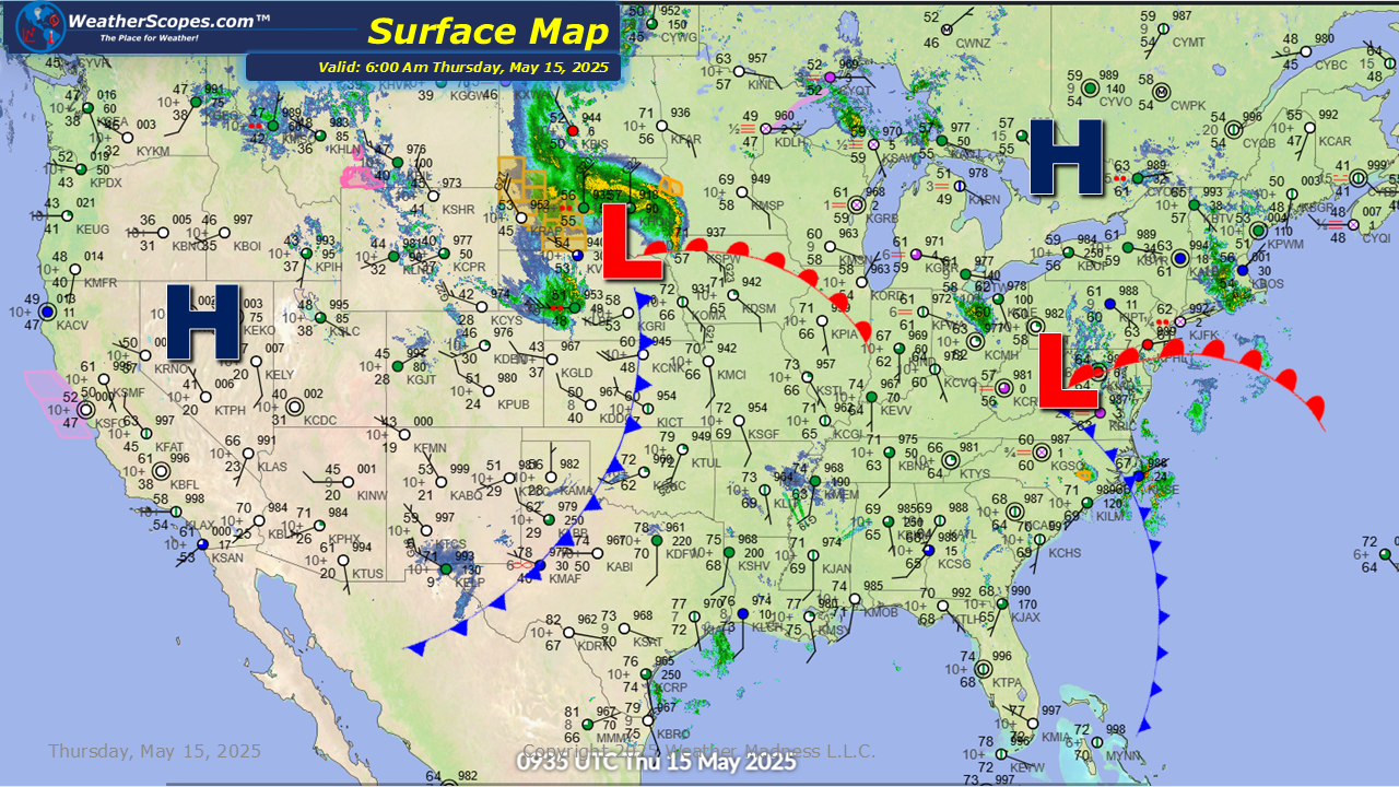
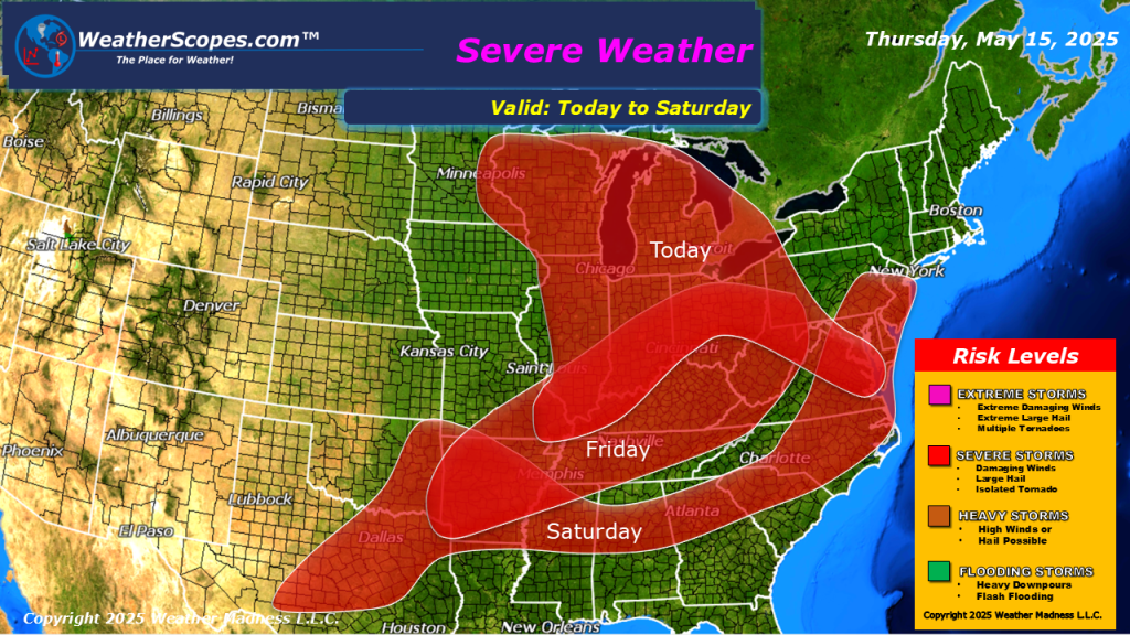
It should be an interesting day today across the Northern Plains into the Great Lakes and Midwest, as severe storms will be a a major concern. This morning showers and thunderstorms are making their way across the Dakota’s and this system will continue into the Upper Great Lakes and into the Midwest later tonight. A line of thunderstorms will develop later today from Minnesota all the way down to Illinois and move to the East. These storms look to produce some gusty conditions, hail, heavy downpours, and some tornadoes are possible. Temperatures and dew points will be high in the areas today so the tornado threat is increasing. Rain and some mountain snow continues in the Pacific NW and into the Northern Rockies, as well as some cooler temps.


Leave a comment