
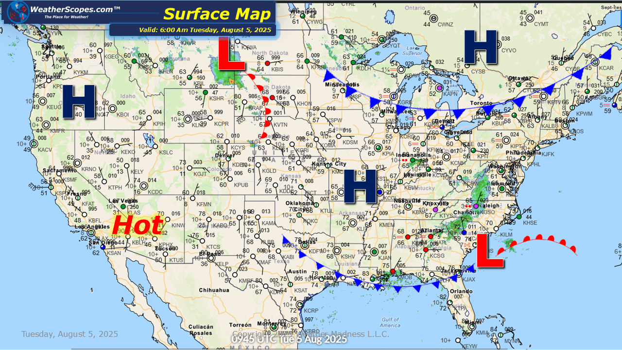
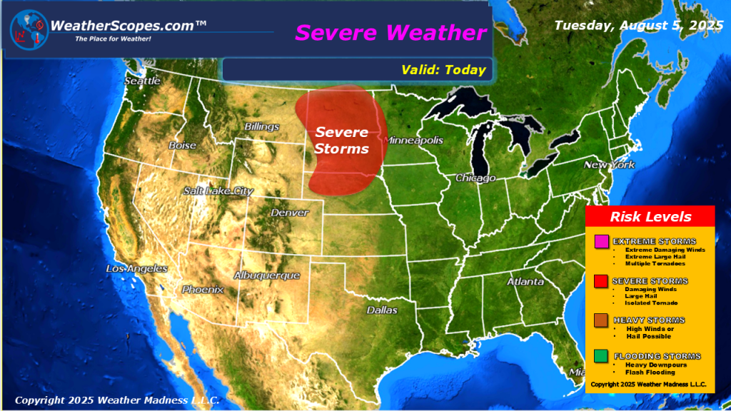
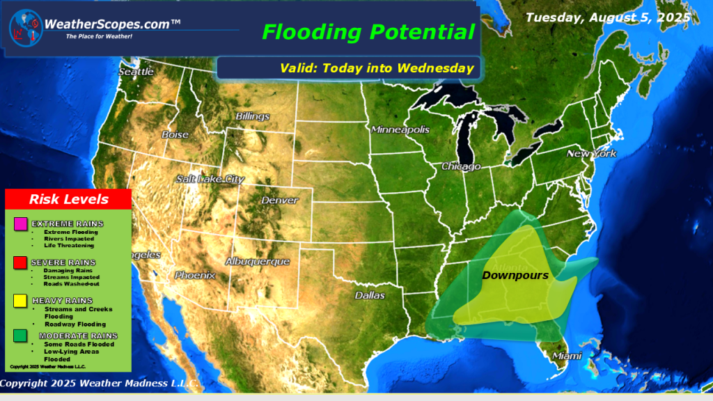
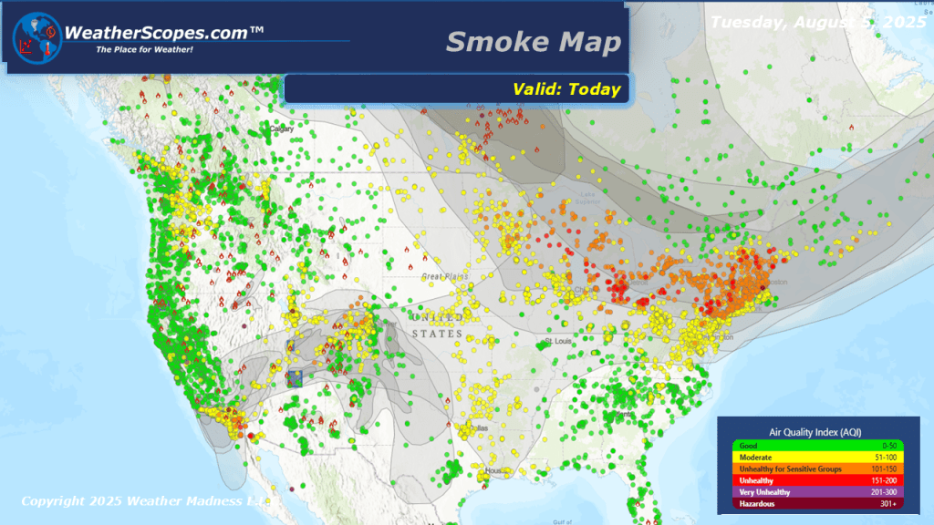
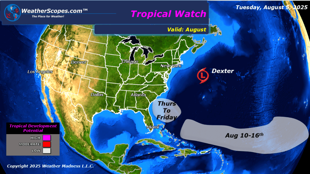
Today more severe weather will break out in the High Plains, brining gusty conditions, hail, and the threat of a tornado or two. The Southeast continues to see heavy rains and possible localized flooding. The Ohio Valley could see some isolated thunderstorms develop later in the day. The air quality for the Midwest, Great Lakes, and parts of the Northeast continue to decline. The wildfires in Canada continue to burn and the smoke continues to make its way further south. The wildfires that we have going on in the west continue to burn and the smoke is making its way east into parts of Texas. Tropical Storm Dexter is out doing its thing in the Atlantic. The heat and humidity looks to return to parts of the Plains and Midwest.

Leave a comment