
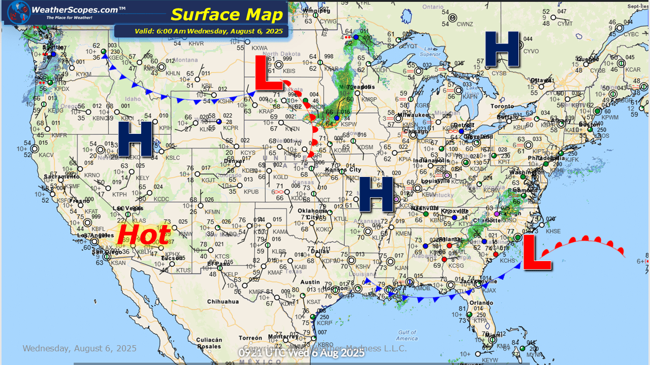
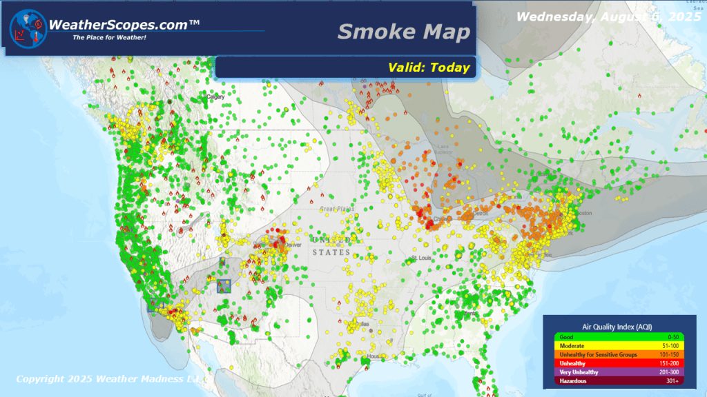
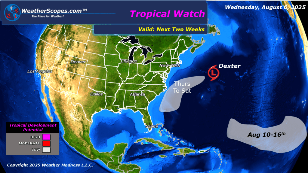
Today severe storms will move into the High Plains into the Upper Great Lakes, bringing the chance for heavy rains, hail, gusty conditions, and a tornado is possible. The Southeast continues to see rainy conditions and the possibility of localized flooding. The smoke from the Canadian wildfires still impacting most of the eastern US, and smoke from wildfires in the west impacting portions of the western US. Another low-pressure system could develop off the Eastern Seaboard over the next few days, as Dexter did days prior. Also keeping an eye out in the tropics to see if anything forms from these tropical waves off the coast of Africa.


Leave a comment