
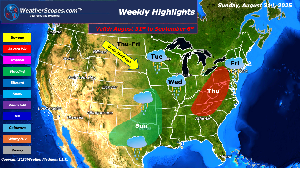
This week we will see some heavy rains, cool temps, and some gusty conditions. From Sunday into Monday, heavy rains will impact the Plains into portions of Texas, bringing the risk of localized and flash flooding. Tuesday and Wednesday, scattered showers and thunderstorms will move through the Upper Great Lakes and the Midwest. Thursday looks to be a busy day of weather this week. A blast of colder air may bring the first signs of snow to Northeastern Minnesota, depending on if temps will get cold enough. A high-pressure system will come into the eastern US on Thursday, bringing cooler, fall-like temperatures to parts of the region. Also on Thursday, severe weather could develop from the Northeast down into the Tennessee Valley, with damaging winds, hail. Gusty winds of 40–50 mph are expected across the Central Plains into the Great Lakes Thursday into Friday, which could cause some power outages. On Friday the Northeast will see more showers and thunderstorms. The western U.S. remains warm and dry, with wildfires continuing to burn and no immediate relief in sight. In the tropics, the Atlantic basin remains quiet for now, though the National Hurricane Center is monitoring a tropical wave off the coast of Africa that could potentially develop into a system next week.
By Matt K.
Meteorologist In-Training

Leave a comment