
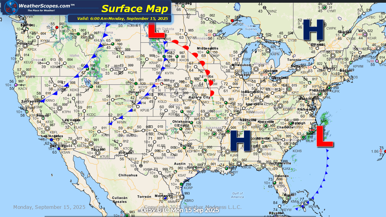
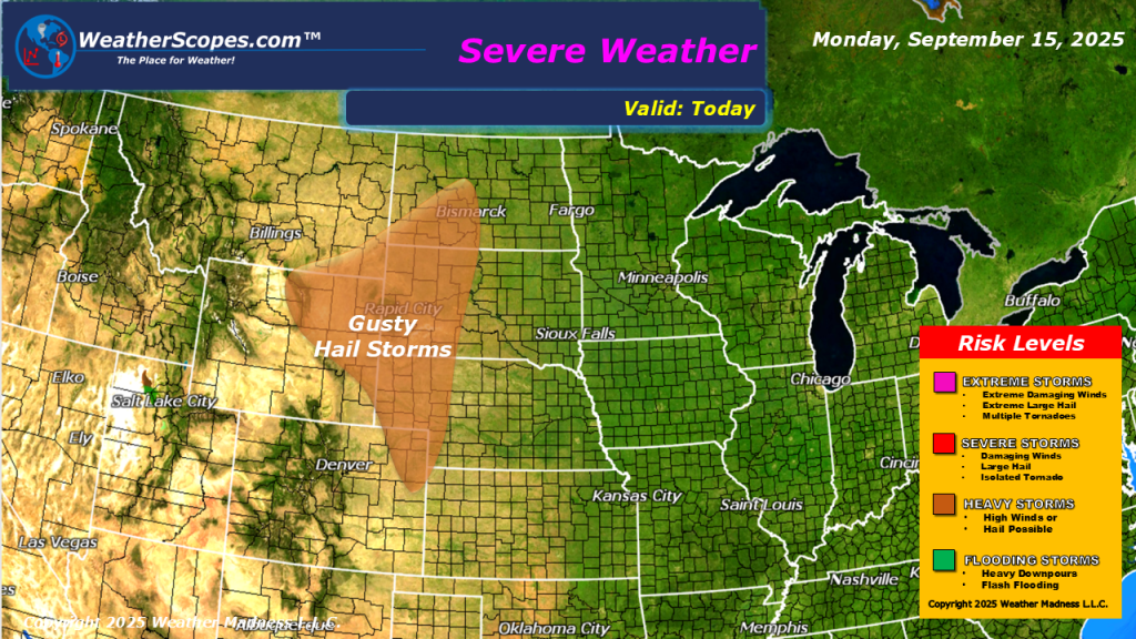
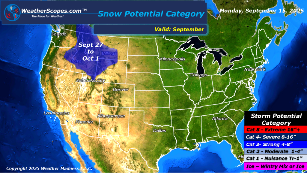
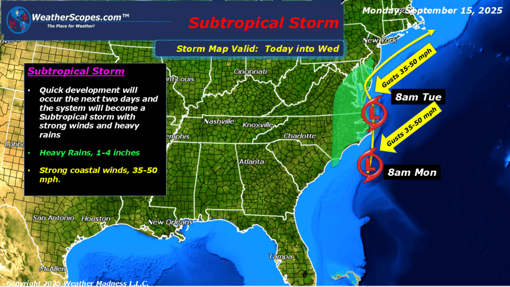
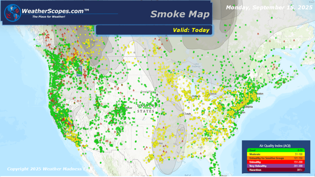
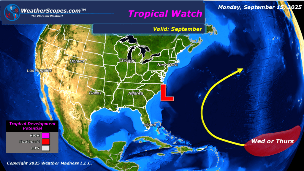
Today the high plains will see some gusty storms after a pretty active day the area saw yesterday, with 22 tornado reports in the Dakota’s. The Northern Rockies could see the first snow this year towards the end of the month. A subtropical-low will impact areas along the East Coast, from Delaware and Maryland south to the Carolinas. Strong winds and heavy rains will be the biggest hazards from this storm. Some areas could see 1-4” of rain, and produce some localized flooding. Smoke from the wildfires out west still impacting the NW, Plains, and Great Lakes. The NHC still watching a tropical wave in the Atlantic, with a 80% chance of forming in the next 7 days. Based on the model tracks this system doesn’t look to have an impact on the US, and will drift off to sea.


Leave a comment